IMAGES TAKEN NEAR TO
Lambourne Road, SOUTHAMPTON, SO18 3LS
Introduction
This page details the photographs taken nearby to Lambourne Road, SO18 3LS by members of the Geograph project.
The Geograph project started in 2005 with the aim of publishing, organising and preserving representative images for every square kilometre of Great Britain, Ireland and the Isle of Man.

There are currently over 7.5m images from over14,400 individuals and you can help contribute to the project by visiting https://www.geograph.org.uk
Image Map
Images are licensed for reuse under creativecommons.org/licenses/by-sa/2.0
Notes
- Clicking on the map will re-center to the selected point.
- The higher the marker number, the further away the image location is from the centre of the postcode.
Image Listing (13 Images Found)
Images are licensed for reuse under creativecommons.org/licenses/by-sa/2.0
Image
Details
Distance
1
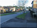
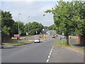
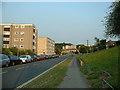
Atalantic Park View
Atalantic Park View leading to Townhill Way
Image: © Shaun Ferguson
Taken: 30 Jan 2013
0.08 miles
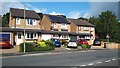
5
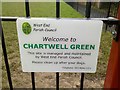
Chartwell Green sign
After a public consultation about building housing on the site, the council decided to maintain the space as a public leisure space and gave it new railings, new benches, and new signage.
Image: © Dave Waghorn
Taken: 31 Dec 2011
0.14 miles
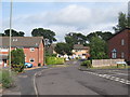
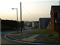
6
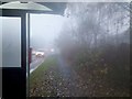
A Townhill Way bus stop in the fog
Townhill Way in Chartwell Green, taken from a foggy bus stop.
Image: © Dave Waghorn
Taken: 22 Nov 2011
0.14 miles
8
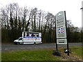
For whom will it be beastly in Eastleigh? (4)
This Labour poster van perhaps overlooks the fact that while both the Tory and Lib Dem candidates were local candidates, Labour went for a high-profile carpetbagger http://en.wikipedia.org/wiki/John_O%27Farrell_(author,_broadcaster_and_politician)
Image: © Basher Eyre
Taken: 28 Feb 2013
0.23 miles
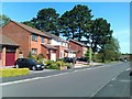
9
Meggeson Avenue, Townhill Park, Southampton
Meggeson Avenue is one of the main roads through the 1960s housing estate known as Townhill Park although it was surprisingly quiet when I visited to Geograph it on a fine summer's evening.
Image: © GaryReggae
Taken: 13 Jul 2005
0.23 miles
10
Meggeson Avenue, Townhill Park, Southampton
Meggeson Avenue, looking North East from near the Western edge of the grid square. Fortunately there is a seat to rest on after the long climb up the hill!
Image: © GaryReggae
Taken: 13 Jul 2005
0.23 miles