IMAGES TAKEN NEAR TO
Oldbury Court, SOUTHAMPTON, SO16 9NZ
Introduction
This page details the photographs taken nearby to Oldbury Court, SO16 9NZ by members of the Geograph project.
The Geograph project started in 2005 with the aim of publishing, organising and preserving representative images for every square kilometre of Great Britain, Ireland and the Isle of Man.

There are currently over 7.5m images from over14,400 individuals and you can help contribute to the project by visiting https://www.geograph.org.uk
Image Map
Images are licensed for reuse under creativecommons.org/licenses/by-sa/2.0
Notes
- Clicking on the map will re-center to the selected point.
- The higher the marker number, the further away the image location is from the centre of the postcode.
Image Listing (40 Images Found)
Images are licensed for reuse under creativecommons.org/licenses/by-sa/2.0
Image
Details
Distance
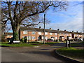
2
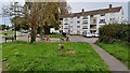
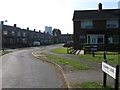
Grass and flats at the end of Colne Avenue
Image: © David Martin
Taken: 13 Oct 2024
0.08 miles
3
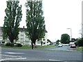
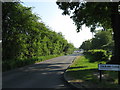
Looking east-northeast in Lower Brownhill Road
Image: © Basher Eyre
Taken: 3 Dec 2014
0.09 miles
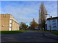
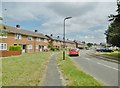
5
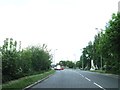
Lower Brownhill Road, Southampton
Viewed from Colburn Close
Image: © Alex McGregor
Taken: 13 May 2010
0.10 miles
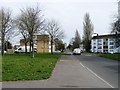
9
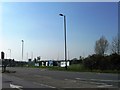
Looking from Lower Brownhill Road into Colburn Close
Image: © Basher Eyre
Taken: 3 Dec 2014
0.11 miles
10
Millbrook, Hayburn Road
Terraced houses off Mansel Road West.
Image: © Mike Faherty
Taken: 1 Jul 2017
0.14 miles