IMAGES TAKEN NEAR TO
Windbury Road, SOUTHAMPTON, SO16 9NP
Introduction
This page details the photographs taken nearby to Windbury Road, SO16 9NP by members of the Geograph project.
The Geograph project started in 2005 with the aim of publishing, organising and preserving representative images for every square kilometre of Great Britain, Ireland and the Isle of Man.

There are currently over 7.5m images from over14,400 individuals and you can help contribute to the project by visiting https://www.geograph.org.uk
Image Map
Images are licensed for reuse under creativecommons.org/licenses/by-sa/2.0
Notes
- Clicking on the map will re-center to the selected point.
- The higher the marker number, the further away the image location is from the centre of the postcode.
Image Listing (21 Images Found)
Images are licensed for reuse under creativecommons.org/licenses/by-sa/2.0
Image
Details
Distance
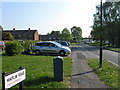
1
Houses and flats in Colne Avenue
Yes, that lamppost is far from vertical.
Image: © David Martin
Taken: 13 Oct 2024
0.08 miles
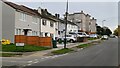
2
Colne Avenue Baptist Church: November 2014
Image: © Basher Eyre
Taken: 20 Nov 2014
0.10 miles
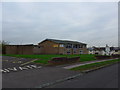
4
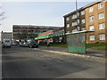
Maybush, shopping parade
At the junction of Windermere Avenue & Green Lane; from the right, bridal wear, pet grooming, newsagent, pizzas, pharmacy, betting, convenience store.
Image: © Mike Faherty
Taken: 2 Mar 2010
0.14 miles
5
Clever wall art on tower block
I think it's really clever the way this wall art has been done on Millbrook towers
Image: © J W Parker
Taken: 12 Aug 2012
0.19 miles
6
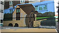
Millbrook Towers art
I love all the wall art around Millbrook Towers, but this particular section the way it includes the flat windows into the art is very clever in my opinion.
Image: © J W Parker
Taken: 12 Aug 2012
0.19 miles
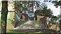
7
Mansel park and Millbook towers
Looking across the old basketball court in Mansel park up towards Millbrook towers
Image: © J W Parker
Taken: 17 Jun 2013
0.19 miles
8
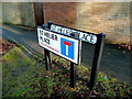
Sign overkill
You would have thought that the new sign would replace the old, not just sit alongside?
Image: © Jonathan Billinger
Taken: 17 Feb 2010
0.19 miles
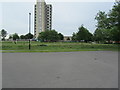
9
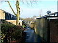
St. Helier Place, Lord's Hill
1970's housing on the north-west side of the greater Southampton conurbation.
Image: © Jonathan Billinger
Taken: 17 Feb 2010
0.21 miles