IMAGES TAKEN NEAR TO
Tetney Close, SOUTHAMPTON, SO16 9NJ
Introduction
This page details the photographs taken nearby to Tetney Close, SO16 9NJ by members of the Geograph project.
The Geograph project started in 2005 with the aim of publishing, organising and preserving representative images for every square kilometre of Great Britain, Ireland and the Isle of Man.

There are currently over 7.5m images from over14,400 individuals and you can help contribute to the project by visiting https://www.geograph.org.uk
Image Map
Images are licensed for reuse under creativecommons.org/licenses/by-sa/2.0
Notes
- Clicking on the map will re-center to the selected point.
- The higher the marker number, the further away the image location is from the centre of the postcode.
Image Listing (32 Images Found)
Images are licensed for reuse under creativecommons.org/licenses/by-sa/2.0
Image
Details
Distance
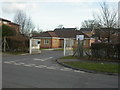
1
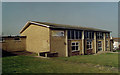
Maybush, academy
Oasisacademy ;lord'shill (sic!), on Green Lane, formerly Millbrook Community School. At least the previous name had conventional punctuation and capitalisation. http://www.oasisacademylordshill.org/
Image: © Mike Faherty
Taken: 2 Mar 2010
0.16 miles
2
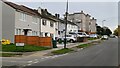
Houses and flats in Colne Avenue
Yes, that lamppost is far from vertical.
Image: © David Martin
Taken: 13 Oct 2024
0.17 miles
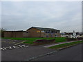
3
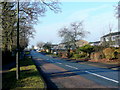
Lower Brownhill Road
Looking west away from Lord's Hill centre.
Image: © Jonathan Billinger
Taken: 17 Feb 2010
0.18 miles
4
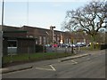
Maybush, driving test centre
Driving Standards Agency centre, on Green Lane. http://www.dsa.gov.uk/AddressDetails_Bannered.asp?id=2365&Cat=-1&Type=17&ShowRoute=0
Image: © Mike Faherty
Taken: 2 Mar 2010
0.18 miles
5
Colne Avenue Baptist Church: November 2014
Image: © Basher Eyre
Taken: 20 Nov 2014
0.19 miles
6
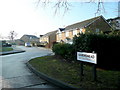
Baronsmead, Lord's Hill
1990's housing off Lower Brownhill Road.
Image: © Jonathan Billinger
Taken: 17 Feb 2010
0.19 miles
7
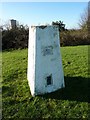
Trig pillar in the grounds of the former Ordnance Survey HQ, Southampton
Image: © Alexander P Kapp
Taken: 19 Jan 2011
0.20 miles
8
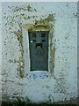
Trig pillar in the grounds of the former Ordnance Survey HQ, Southampton, Flush bracket
Image: © Alexander P Kapp
Taken: 19 Jan 2011
0.20 miles
9
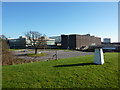
Trig pillar and former Ordnance Survey HQ, Southampton
Image: © Alexander P Kapp
Taken: 19 Jan 2011
0.20 miles