IMAGES TAKEN NEAR TO
Goldcrest Gardens, SOUTHAMPTON, SO16 8FG
Introduction
This page details the photographs taken nearby to Goldcrest Gardens, SO16 8FG by members of the Geograph project.
The Geograph project started in 2005 with the aim of publishing, organising and preserving representative images for every square kilometre of Great Britain, Ireland and the Isle of Man.

There are currently over 7.5m images from over14,400 individuals and you can help contribute to the project by visiting https://www.geograph.org.uk
Image Map
Images are licensed for reuse under creativecommons.org/licenses/by-sa/2.0
Notes
- Clicking on the map will re-center to the selected point.
- The higher the marker number, the further away the image location is from the centre of the postcode.
Image Listing (14 Images Found)
Images are licensed for reuse under creativecommons.org/licenses/by-sa/2.0
Image
Details
Distance
1
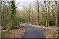
Path and Cycleway at Lord's Hill
Running from Sandpiper Road to Lord's Hill Way.
Image: © Peter Facey
Taken: 11 Mar 2009
0.04 miles
2
Path and Cycleway, Sandpiper Road
The path, and more recently built cycleway, run from Sandpiper Way to Lord's Hill Way.
Image: © Peter Facey
Taken: 11 Mar 2009
0.05 miles
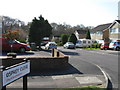
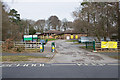
4
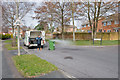
Gannet Close joins Sandpiper Road
The van provides a service pressure washing wheeliebins on the same day they are emptied, see ecowheeliebin at http://www.ecowheeliebin.co.uk/
Image: © Peter Facey
Taken: 11 Mar 2009
0.07 miles
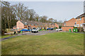
6
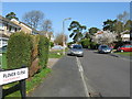
Plover Close, Lordswood
Looking across Sandpiper Road.
Image: © Peter Facey
Taken: 11 Mar 2009
0.13 miles
8
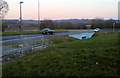
Lordshill Way
Lordshill Way, one of the main and direct routes for connections between Lordshill and Southampton City Centre, this road follows down past the Sports Centre and Southampton Common. The other direct route is via Maybush and Shirley. The approximate distance between here and the city centre is about 3½ miles.
Image: © Lee
Taken: 17 Feb 2008
0.19 miles
9
Oakwood Infant and Junior Schools, Lordswood
See http://www.oakwood-inf.southampton.sch.uk/ and http://www.oakwood-jun.southampton.sch.uk/
Image: © Peter Facey
Taken: 11 Mar 2009
0.19 miles
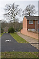
10
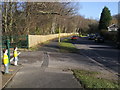
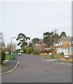
Sandpiper Road
Sandpiper Road by Oakwood Infant School
Image: © Shaun Ferguson
Taken: 30 Jan 2013
0.20 miles