IMAGES TAKEN NEAR TO
Manningford Bohune, PEWSEY, SN9 6NR
Introduction
This page details the photographs taken nearby to SN9 6NR by members of the Geograph project.
The Geograph project started in 2005 with the aim of publishing, organising and preserving representative images for every square kilometre of Great Britain, Ireland and the Isle of Man.

There are currently over 7.5m images from over14,400 individuals and you can help contribute to the project by visiting https://www.geograph.org.uk
Image Map (Loading...)


Getting Data...Please wait
Leaflet Map data © OpenStreetMap
Images are licensed for reuse under creativecommons.org/licenses/by-sa/2.0
Notes
- Clicking on the map will re-center to the selected point.
- The higher the marker number, the further away the image location is from the centre of the postcode.
Image Listing (10 Images Found)
Images are licensed for reuse under creativecommons.org/licenses/by-sa/2.0
Image
Details
Distance
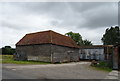
1
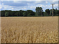
Farmland, Manningford Bohune
A crop of oats on flat land to the east of the River Avon.
Image: © Andrew Smith
Taken: 25 Jul 2009
0.08 miles
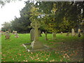
2
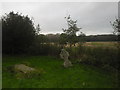
St. James' churchyard North Newnton (2)
Image: © Basher Eyre
Taken: 27 Oct 2014
0.10 miles
3
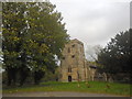
St. James' church North Newnton: October 2014
Image: © Basher Eyre
Taken: 27 Oct 2014
0.11 miles
4
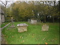
St. James' churchyard North Newnton (3)
Image: © Basher Eyre
Taken: 27 Oct 2014
0.11 miles
5
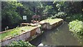
Weir behind St James's Church at North Newnton
Image: © David Martin
Taken: 23 Jun 2023
0.11 miles
6
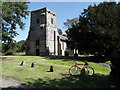
St. James' church North Newnton
The strange projections on the tower are the beams of the bell cradle
Image: © Kevin Farmer
Taken: 10 Sep 2009
0.12 miles
7
St. James' churchyard North Newnton (1)
Image: © Basher Eyre
Taken: 27 Oct 2014
0.12 miles
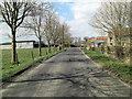
8
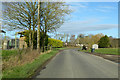
Road heading north by Falkner's Farm, North Newnton
Image: © Robin Webster
Taken: 2 Feb 2018
0.24 miles
10
Un-named road passes through Falkner's Farm
Image: © Stuart Logan
Taken: 29 Mar 2013
0.25 miles