IMAGES TAKEN NEAR TO
Fairfield, PEWSEY, SN9 6DZ
Introduction
This page details the photographs taken nearby to Fairfield, SN9 6DZ by members of the Geograph project.
The Geograph project started in 2005 with the aim of publishing, organising and preserving representative images for every square kilometre of Great Britain, Ireland and the Isle of Man.

There are currently over 7.5m images from over14,400 individuals and you can help contribute to the project by visiting https://www.geograph.org.uk
Image Map
Images are licensed for reuse under creativecommons.org/licenses/by-sa/2.0
Notes
- Clicking on the map will re-center to the selected point.
- The higher the marker number, the further away the image location is from the centre of the postcode.
Image Listing (78 Images Found)
Images are licensed for reuse under creativecommons.org/licenses/by-sa/2.0
Image
Details
Distance
1
Old Milestone by the A342, Devizes Road, Upavon
Stone post (plate lost) by the A342, in parish of UPAVON (KENNET District), Devizes Road; 130m East of the junction with the A345 and one way section opposite No. 4, on the verge, on South side of road. Everleigh iron plate, erected by the Everley turnpike trust in the 19th century.
Inscription once read:-
(DEVIZES)
(9 MILES)
(EVERLEIGH)
(5)
(ANDOVER)
(17)
Carved benchmark not visible, but rivet on top.
Milestone Society National ID: WI_DZAV09.
Image: © M Faherty
Taken: 14 Jun 2008
0.08 miles
2
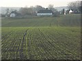
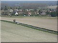
Farmland and the edge of Upavon
Looking across to cottages and houses in the Chapel Street and Jarvis Street area from Green Way, a bridleway to the north.
Image: © Andrew Smith
Taken: 8 Apr 2007
0.12 miles
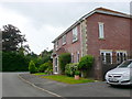
3
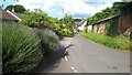
Devizes Road (A342), Upavon
The thatched cottage is known as The Dairy
Image: © John Baker
Taken: 2 Apr 2011
0.12 miles
5
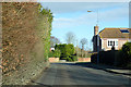
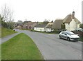
Entering Upavon from the south
On the A345 from the Salisbury direction.
Image: © Robin Webster
Taken: 2 Feb 2018
0.13 miles
6
Southern edge of Upavon
Looking across the stretch of A road (not numbered by the Ordnance Survey) linking the A342 and the A345.
Image: © Andrew Smith
Taken: 8 Apr 2007
0.13 miles
9
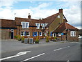
House in Alexander Fields
This modern detached house is on the corner of Alexander fields and the A345 main road which can be seen in the background.
Image: © Nigel Mykura
Taken: 23 Jun 2013
0.15 miles
10
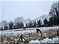
Gypsy encampment, Upavon
Two painted caravans and a couple of tethered ponies shelter against the hedge in a field of rough grass on the edge of the village.
Image: © Maigheach-gheal
Taken: 14 Jan 2010
0.15 miles