
IMAGES TAKEN NEAR TO
Field View, PEWSEY, SN9 6DW
Introduction
This page details the photographs taken nearby to Field View, SN9 6DW by members of the Geograph project.
The Geograph project started in 2005 with the aim of publishing, organising and preserving representative images for every square kilometre of Great Britain, Ireland and the Isle of Man.

There are currently over 7.5m images from over14,400 individuals and you can help contribute to the project by visiting https://www.geograph.org.uk
Image Map
Images are licensed for reuse under creativecommons.org/licenses/by-sa/2.0
Notes
- Clicking on the map will re-center to the selected point.
- The higher the marker number, the further away the image location is from the centre of the postcode.
Image Listing (3 Images Found)
Images are licensed for reuse under creativecommons.org/licenses/by-sa/2.0
Image
Details
Distance
1
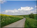
Water Lane, east of Lower Enford Farm
A very narrow lane leading up to the open downland of Salisbury Plain from the Avon valley. Oil-seed rape on the left, grazing land on the steeper slopes to the right. This is all MoD land.
Image: © Stefan Czapski
Taken: 16 May 2016
0.19 miles
2
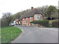
Old Bengers
This cottage is Grade II listed and dates from the early 19th C. It uses locally available vernacular building materials: thatch, flint, brick and clunch. The latter is a soft rock comprising naturally compressed chalk. It does not weather well but is readily available in calciferous areas. English Heritage Building ID: 310987.
Image: © Stuart Logan
Taken: 25 Apr 2013
0.20 miles
3
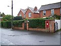
Postbox, Enford
The postbox is George VI.
Image: © Maigheach-gheal
Taken: 6 Sep 2008
0.24 miles