IMAGES TAKEN NEAR TO
The Sands, PEWSEY, SN9 5PR
Introduction
This page details the photographs taken nearby to The Sands, SN9 5PR by members of the Geograph project.
The Geograph project started in 2005 with the aim of publishing, organising and preserving representative images for every square kilometre of Great Britain, Ireland and the Isle of Man.

There are currently over 7.5m images from over14,400 individuals and you can help contribute to the project by visiting https://www.geograph.org.uk
Image Map
Images are licensed for reuse under creativecommons.org/licenses/by-sa/2.0
Notes
- Clicking on the map will re-center to the selected point.
- The higher the marker number, the further away the image location is from the centre of the postcode.
Image Listing (28 Images Found)
Images are licensed for reuse under creativecommons.org/licenses/by-sa/2.0
Image
Details
Distance
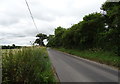
3
![Four ways to go [4]](https://s2.geograph.org.uk/geophotos/04/49/81/4498174_df4a9d31_120x120.jpg)
Four ways to go [4]
A footpath crosses Hurst's Lane, resulting in four ways to go. This is the driveway to Hurst's Farm which is also a public footpath heading north towards Honeystreet and the Kennet and Avon Canal.
Image: © Michael Dibb
Taken: 23 May 2015
0.06 miles
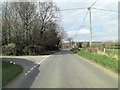
4
The Sands, Woodborough
National Cycle Route 45.
Image: © JThomas
Taken: 13 Jul 2019
0.07 miles
5
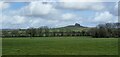
Woodborough, Wiltshire
Looking across farmland in the direction of Woodborough Hill from the outskirts of Woodborough village.
Image: © Rebecca A Wills
Taken: 12 Mar 2021
0.07 miles
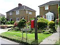
6
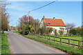
The Sands
Dwelling north of Woodborough.
Image: © Wayland Smith
Taken: 30 Mar 2021
0.07 miles
7
![Four ways to go [3]](https://s1.geograph.org.uk/geophotos/04/49/81/4498169_1f0cef25_120x120.jpg)
Four ways to go [3]
A footpath crosses Hurst's Lane, resulting in four ways to go. This is Hurst's Lane, a public road heading east towards the minor road 'The Sands'.
Image: © Michael Dibb
Taken: 23 May 2015
0.09 miles
8
![Four ways to go [1]](https://s2.geograph.org.uk/geophotos/04/49/81/4498158_57eec7b7_120x120.jpg)
Four ways to go [1]
A footpath crosses Hurst's Lane, resulting in four ways to go. This is the footpath heading south towards Smithy Lane and Sunnymead Farm.
Image: © Michael Dibb
Taken: 23 May 2015
0.09 miles
9
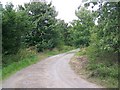
Track to Hurst's Farm
The track to Hurst's Farm acts as a footpath which continues from the farm to Honey Street Farm.
Image: © Maigheach-gheal
Taken: 3 Aug 2009
0.09 miles
10
![Four ways to go [2]](https://s2.geograph.org.uk/geophotos/04/49/81/4498162_b174ad46_120x120.jpg)
Four ways to go [2]
A footpath crosses Hurst's Lane, resulting in four ways to go. This is Hurst's Lane, a track that is also a public bridleway, heading west towards Mill Farm and the minor road to Stanton Dairy.
Image: © Michael Dibb
Taken: 23 May 2015
0.10 miles