IMAGES TAKEN NEAR TO
Manningford Abbots, PEWSEY, SN9 5PB
Introduction
This page details the photographs taken nearby to SN9 5PB by members of the Geograph project.
The Geograph project started in 2005 with the aim of publishing, organising and preserving representative images for every square kilometre of Great Britain, Ireland and the Isle of Man.

There are currently over 7.5m images from over14,400 individuals and you can help contribute to the project by visiting https://www.geograph.org.uk
Image Map
Images are licensed for reuse under creativecommons.org/licenses/by-sa/2.0
Notes
- Clicking on the map will re-center to the selected point.
- The higher the marker number, the further away the image location is from the centre of the postcode.
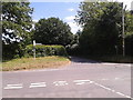
Image Listing (6 Images Found)
Images are licensed for reuse under creativecommons.org/licenses/by-sa/2.0
Image
Details
Distance
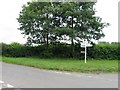
1

Un-named lane approaches junction of Woodborough Road and Hare Street
Image: © Stuart Logan
Taken: 16 May 2012
0.02 miles
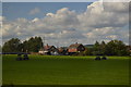
5
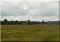
Rough grazing near Wilcot
The house in the distance is in the next square. Is that a dog running through the grazing land to the left? Too late, we've gone.
This photo was taken from the 1158 Penzance to London Paddington train, having left Castle Cary at 1550.
Image: © Graham Horn
Taken: 9 Jul 2011
0.16 miles
