
IMAGES TAKEN NEAR TO
Wheeler Close, PEWSEY, SN9 5HZ
Introduction
This page details the photographs taken nearby to Wheeler Close, SN9 5HZ by members of the Geograph project.
The Geograph project started in 2005 with the aim of publishing, organising and preserving representative images for every square kilometre of Great Britain, Ireland and the Isle of Man.

There are currently over 7.5m images from over14,400 individuals and you can help contribute to the project by visiting https://www.geograph.org.uk
Image Map
Images are licensed for reuse under creativecommons.org/licenses/by-sa/2.0
Notes
- Clicking on the map will re-center to the selected point.
- The higher the marker number, the further away the image location is from the centre of the postcode.
Image Listing (106 Images Found)
Images are licensed for reuse under creativecommons.org/licenses/by-sa/2.0
Image
Details
Distance
1
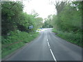
A345 junction with Old Hospital Road
This is also the point where the Marlborough Road enters Pewsey.
Image: © Stuart Logan
Taken: 16 May 2012
0.10 miles
2
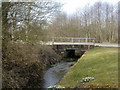
Pewsey, Ford Brook
Looking upstream as the brook crosses Marlborough Road; it joins River Avon shortly to the East.
Image: © Mike Faherty
Taken: 16 Mar 2010
0.11 miles
3

Netherleaze play area
There are several such little play spaces hereabouts. The recent development of the area near the old hospital has given much thought about its facilities.
Image: © Neil Owen
Taken: 30 Apr 2026
0.13 miles
4
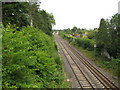
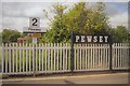
Pewsey: Main railway line to London, 75? miles ahead
Well, the 1889 Ordnance Survey 6" to the mile map shows a railway mile post at 75 miles to London about ½ mile to the east of here beyond Pewsey railway station, and another at 76 miles to London about ½ mile to the west of here, and I do not think that the route has changed since. This is the view from the Walcot Road bridge.
Image: © Nigel Cox
Taken: 10 Jul 2009
0.14 miles
5
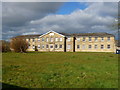
Pewsey - Former Union Workhouse
Pewsey Union workhouse was erected in 1836 on a site at the west of Pewsey. The Poor Law Commissioners authorised an expenditure of £3,213 on construction of the building which was to accommodate 200 inmates. It has nowbeen converted into housing.
Image: © Chris Talbot
Taken: 19 Feb 2012
0.14 miles
6
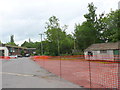
Fordbrook Business Centre
This small industrial estate on the outskirts of pewsey just next to the Fordbrook, houses a range of small commercial companies.
Image: © Nigel Mykura
Taken: 23 Jun 2013
0.14 miles
8
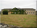
Pewsey: Former Union Workhouse
Pewsey Union Workhouse was built here on Walcot Road in 1836. By 1926 the Ordnance Survey were describing the building as the Poor Law Institution, and by 1930 it had become Pewsey Mental Hospital. The building has now been redeveloped as private housing and the site is surrounded on three sides by new homes. However the windows of the building on the ground floor on the left are currently boarded up.
Image: © Nigel Cox
Taken: 10 Jul 2009
0.14 miles
9
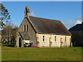
Pewsey - Former Hospital Chapel
Workhouse chapel. c1840-50. Limestone ashlar with slate roof. Three bays, with gabled western porch. Lancet windows between buttresses. Three light eastern lancets. Bellcote over west gable.
Image: © Chris Talbot
Taken: 19 Feb 2012
0.15 miles
10
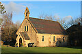
Former Chapel
Former Chapel in Pewsey.
Image: © Wayland Smith
Taken: 24 Dec 2020
0.15 miles