IMAGES TAKEN NEAR TO
Stanton St. Bernard, MARLBOROUGH, SN8 4LF
Introduction
This page details the photographs taken nearby to SN8 4LF by members of the Geograph project.
The Geograph project started in 2005 with the aim of publishing, organising and preserving representative images for every square kilometre of Great Britain, Ireland and the Isle of Man.

There are currently over 7.5m images from over14,400 individuals and you can help contribute to the project by visiting https://www.geograph.org.uk
Image Map (Loading...)


Getting Data...Please wait
Leaflet Map data © OpenStreetMap
Images are licensed for reuse under creativecommons.org/licenses/by-sa/2.0
Notes
- Clicking on the map will re-center to the selected point.
- The higher the marker number, the further away the image location is from the centre of the postcode.
Image Listing (85 Images Found)
Images are licensed for reuse under creativecommons.org/licenses/by-sa/2.0
Image
Details
Distance
1
![From Stanton St Bernard to Wansdyke and return [2]](https://s1.geograph.org.uk/geophotos/06/56/94/6569409_5c54e127_120x120.jpg)
From Stanton St Bernard to Wansdyke and return [2]
The footpath continues alongside the small stream towards the minor road.
Leaving the village a footpath heads towards and then ascends Milk Hill (which at 968 feet (295 metres) is the highest point in Wiltshire) and leads on to Wansdyke. A bridleway runs alongside the dyke before forking right to New Town. An ascent of Walkers Hill, a glimpse of the Alton Barnes White Horse and a visit to Adam’s Grave before descending to Alton Priors and a footpath back to Stanton St Bernard. About 6½ miles.
Image: © Michael Dibb
Taken: 1 May 2020
0.02 miles
2
![Stanton St Bernard houses [4]](https://s2.geograph.org.uk/geophotos/06/57/55/6575550_0d3b3901_120x120.jpg)
Stanton St Bernard houses [4]
Mulberry Cottage is a delightful brick built and thatched cottage.
Stanton St Bernard is a small former agricultural village in the Vale of Pewsey about 6 miles east of Devizes. The parish includes Milk Hill, at 968 feet (295 metres) the highest point in Wiltshire.
Image: © Michael Dibb
Taken: 1 May 2020
0.03 miles
3
![Stanton St Bernard features [1]](https://s3.geograph.org.uk/geophotos/06/57/55/6575559_8362b937_120x120.jpg)
Stanton St Bernard features [1]
A fine laburnum tree.
Stanton St Bernard is a small former agricultural village in the Vale of Pewsey about 6 miles east of Devizes. The parish includes Milk Hill, at 968 feet (295 metres) the highest point in Wiltshire.
Image: © Michael Dibb
Taken: 22 May 2020
0.03 miles
4
![From Stanton St Bernard to Wansdyke and return [1]](https://s3.geograph.org.uk/geophotos/06/56/94/6569407_a2dd5e10_120x120.jpg)
From Stanton St Bernard to Wansdyke and return [1]
Calf Lane which leads off Church Road becomes a footpath at this point.
Leaving the village a footpath heads towards and then ascends Milk Hill (which at 968 feet (295 metres) is the highest point in Wiltshire) and leads on to Wansdyke. A bridleway runs alongside the dyke before forking right to New Town. An ascent of Walkers Hill, a glimpse of the Alton Barnes White Horse and a visit to Adam’s Grave before descending to Alton Priors and a footpath back to Stanton St Bernard. About 6½ miles.
Image: © Michael Dibb
Taken: 1 May 2020
0.04 miles
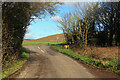
5
![From Stanton St Bernard to Wansdyke and return [3]](https://s3.geograph.org.uk/geophotos/06/56/94/6569411_a4b2d9dd_120x120.jpg)
From Stanton St Bernard to Wansdyke and return [3]
The footpath from Calf Lane meets the minor road.
Leaving the village a footpath heads towards and then ascends Milk Hill (which at 968 feet (295 metres) is the highest point in Wiltshire) and leads on to Wansdyke. A bridleway runs alongside the dyke before forking right to New Town. An ascent of Walkers Hill, a glimpse of the Alton Barnes White Horse and a visit to Adam’s Grave before descending to Alton Priors and a footpath back to Stanton St Bernard. About 6½ miles.
Image: © Michael Dibb
Taken: 1 May 2020
0.06 miles
6
![Stanton St Bernard houses [3]](https://s1.geograph.org.uk/geophotos/06/57/55/6575537_f335b6fa_120x120.jpg)
Stanton St Bernard houses [3]
The house, Spring Cottage, is now two dwellings, Built in the mid 17th century, timber framed on sarsen footings, with brick noggings and a thatched roof. Some original internal features remain. Another view of the house is at Image Listed, grade II, with details at: https://historicengland.org.uk/listing/the-list/list-entry/1193915
Stanton St Bernard is a small former agricultural village in the Vale of Pewsey about 6 miles east of Devizes. The parish includes Milk Hill, at 968 feet (295 metres) the highest point in Wiltshire.
Image: © Michael Dibb
Taken: 1 May 2020
0.06 miles
7
![Stanton St Bernard houses [2]](https://s2.geograph.org.uk/geophotos/06/57/55/6575530_5f8927ff_120x120.jpg)
Stanton St Bernard houses [2]
The house, Spring Cottage is now two dwellings, Built in the mid 17th century, timber framed on sarsen footings, with brick noggings and a thatched roof. Some original internal features remain. Another view of the house is at Image Listed, grade II, with details at: https://historicengland.org.uk/listing/the-list/list-entry/1193915
Stanton St Bernard is a small former agricultural village in the Vale of Pewsey about 6 miles east of Devizes. The parish includes Milk Hill, at 968 feet (295 metres) the highest point in Wiltshire.
Image: © Michael Dibb
Taken: 1 May 2020
0.07 miles
8
Stanton St Bernard
Road junction on the edge of the village.
Image: © Wayland Smith
Taken: 24 Dec 2020
0.07 miles
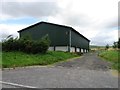
10
![From Stanton St Bernard to Wansdyke and return [4]](https://s1.geograph.org.uk/geophotos/06/56/94/6569413_71f707a5_120x120.jpg)
From Stanton St Bernard to Wansdyke and return [4]
Opposite where the footpath meets the minor road a footpath runs past the wonderfully named Tintown Barn towards Tan Hill.
Leaving the village a footpath heads towards and then ascends Milk Hill (which at 968 feet (295 metres) is the highest point in Wiltshire) and leads on to Wansdyke. A bridleway runs alongside the dyke before forking right to New Town. An ascent of Walkers Hill, a glimpse of the Alton Barnes White Horse and a visit to Adam’s Grave before descending to Alton Priors and a footpath back to Stanton St Bernard. About 6½ miles.
Image: © Michael Dibb
Taken: 1 May 2020
0.10 miles