
IMAGES TAKEN NEAR TO
Hertford Road, MARLBOROUGH, SN8 4AW
Introduction
This page details the photographs taken nearby to Hertford Road, SN8 4AW by members of the Geograph project.
The Geograph project started in 2005 with the aim of publishing, organising and preserving representative images for every square kilometre of Great Britain, Ireland and the Isle of Man.

There are currently over 7.5m images from over14,400 individuals and you can help contribute to the project by visiting https://www.geograph.org.uk
Image Map
Images are licensed for reuse under creativecommons.org/licenses/by-sa/2.0
Notes
- Clicking on the map will re-center to the selected point.
- The higher the marker number, the further away the image location is from the centre of the postcode.
Image Listing (39 Images Found)
Images are licensed for reuse under creativecommons.org/licenses/by-sa/2.0
Image
Details
Distance
1
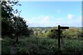
Footpath junction, Postern Hill, Savernake Forest
A permissive path meeting a public right of way path on the slope of Postern Hill, with the edge of Marlborough at the base of the hill.
Image: © Tim Heaton
Taken: 5 Oct 2021
0.05 miles
2
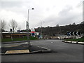
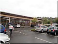
Business Needs
A346 at the roundabout with Tescos on the edge of the Wiltshire town of Marlborough heading towards Savernake and Salisbury (to the right of this image)
Image: © Chris
Taken: 28 Feb 2011
0.06 miles
3
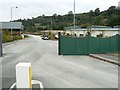
Business park and Postern Hill, Salisbury Road, Marlborough
Postern Hill is visible in the background. The business park is still in the early stages of development and the maps do not yet show the park.
Image: © Brian Robert Marshall
Taken: 24 Oct 2007
0.07 miles
4
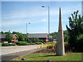
Business Park
Three years on from Image
The site is much more established, with many businesses and healthy looking bushes.
There are also these pointy things at the entrance. They don't seem to do anything. Can a point be pointless. I guess so.
Image: © Des Blenkinsopp
Taken: 1 Jun 2010
0.07 miles
6
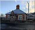
Salisbury Hill Lodge
Salisbury Hill Lodge, dated 1886 above the door, on the Salisbury road, the last house in town before you enter Savernake Forest.
Image: © AJD
Taken: 10 Dec 2022
0.09 miles
7
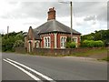
Marlborough Outskirts
House on the edge of Savernake Forest.
Image: © Ian Rob
Taken: 1 Jul 2016
0.09 miles
8
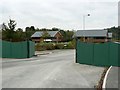
Business park, Salisbury Road, Marlborough
The business park is in the early stages of development but there is one early occupier, a firm of solicitors. The development is not yet on the maps.
Image: © Brian Robert Marshall
Taken: 24 Oct 2007
0.09 miles
9
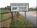
Welcome to Marlborough
Marlborough with its twin towns, the town with apparently one of the widest high streets in the UK.
Image: © Chris
Taken: 28 Feb 2011
0.09 miles
10
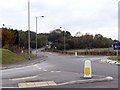
Salisbury Road, Marlborough
Salisbury Road climbs up Postern Hill south of Marlborough and passes through Savernake Forest on its way to Salisbury in south Wiltshire. The roundabout is fairly new and appears on the 1:50K map but not the 1:25K version.
Image: © Brian Robert Marshall
Taken: 24 Oct 2007
0.10 miles