
IMAGES TAKEN NEAR TO
Orchard Road, MARLBOROUGH, SN8 4AU
Introduction
This page details the photographs taken nearby to Orchard Road, SN8 4AU by members of the Geograph project.
The Geograph project started in 2005 with the aim of publishing, organising and preserving representative images for every square kilometre of Great Britain, Ireland and the Isle of Man.

There are currently over 7.5m images from over14,400 individuals and you can help contribute to the project by visiting https://www.geograph.org.uk
Image Map
Images are licensed for reuse under creativecommons.org/licenses/by-sa/2.0
Notes
- Clicking on the map will re-center to the selected point.
- The higher the marker number, the further away the image location is from the centre of the postcode.
Image Listing (81 Images Found)
Images are licensed for reuse under creativecommons.org/licenses/by-sa/2.0
Image
Details
Distance
1
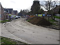
Marlborough (High Level) railway station (site), Wiltshire
Opened in 1864 by the Great Western Railway as the terminus of a short branch line from Savernake, this station closed to passengers in 1933 and completely in 1964. Passenger services were transferred to the Marlborough Low Level station (see Image) some 10 years after they had taken control of both stations.
View south west along the site of the platform, away from the buffers. The site is now in the middle of a housing estate.
Image: © Nigel Thompson
Taken: 14 Mar 2019
0.09 miles
2
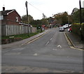
Ducks Meadow, Marlborough
The dead end road Ducks Meadow ascends from the B3052 George Lane.
Image: © Jaggery
Taken: 14 Oct 2017
0.11 miles
4
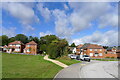
Footpath to Marlborough town centre
Leading through the new Marleberg Grange housing estate
Image: © Tim Heaton
Taken: 5 Oct 2021
0.14 miles
5

Queen Elizabeth II postbox, George Lane, Marlborough
Opposite a pelican crossing. Ducks Meadow http://www.geograph.org.uk/photo/5570480 is on the right.
Image: © Jaggery
Taken: 14 Oct 2017
0.15 miles
6
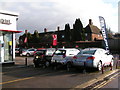
Car showroom at the corner of Figgins Lane
Image: © Rob Purvis
Taken: 27 Dec 2009
0.16 miles
7
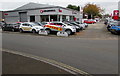
Vauxhall dealership in Marlborough
The business is Now Vauxhall Marlborough viewed across the corner of Figgins Lane and the B3052 George Lane. The new Vauxhall Mokka X is prominently displayed in mid October 2017.
Image: © Jaggery
Taken: 14 Oct 2017
0.16 miles
8
![Marlborough houses [1]](https://s0.geograph.org.uk/geophotos/05/49/17/5491772_27a66ff7_120x120.jpg)
Marlborough houses [1]
This delightfully eccentric property, number 58 George Lane, is listed, grade II, with details at: https://www.historicengland.org.uk/listing/the-list/list-entry/1261999
Marlborough is a market town on the Old Bath Road once the main road from London to Bath. The twice-weekly market is sited in High Street, one of the widest in England, lined on both sides with fine listed buildings of which the town has almost 300. There is evidence of local settlement from every period from the prehistoric to the present day. The town is home to the renowned Marlborough College. The River Kennet flows through the town.
Image: © Michael Dibb
Taken: 17 Jul 2017
0.18 miles
9

Travis Perkins, Marlborough
Set back from the north side of the B3052 George Lane.
Image: © Jaggery
Taken: 14 Oct 2017
0.18 miles
10

The Mobility Store, Marlborough
Mobility aids store viewed across Figgins Lane from the corner of the B3052 George Lane.
Image: © Jaggery
Taken: 14 Oct 2017
0.19 miles