IMAGES TAKEN NEAR TO
Wolfhall Road, MARLBOROUGH, SN8 3TN
Introduction
This page details the photographs taken nearby to Wolfhall Road, SN8 3TN by members of the Geograph project.
The Geograph project started in 2005 with the aim of publishing, organising and preserving representative images for every square kilometre of Great Britain, Ireland and the Isle of Man.

There are currently over 7.5m images from over14,400 individuals and you can help contribute to the project by visiting https://www.geograph.org.uk
Image Map
Images are licensed for reuse under creativecommons.org/licenses/by-sa/2.0
Notes
- Clicking on the map will re-center to the selected point.
- The higher the marker number, the further away the image location is from the centre of the postcode.
Image Listing (58 Images Found)
Images are licensed for reuse under creativecommons.org/licenses/by-sa/2.0
Image
Details
Distance
1
![Burbage houses [32]](https://s1.geograph.org.uk/geophotos/07/40/13/7401385_89368315_120x120.jpg)
Burbage houses [32]
Little Estcotts, in Firs Green Lane, is a house of many periods. Originally built in 1675 with extensions in circa the mid 18th century and circa the early 19th century. Further additions were made circa 1966 and circa 1980. Constructed of brick under a thatch roof. The property was a bakery and shop in the 19th century. Listed, grade II, with details at: https://historicengland.org.uk/listing/the-list/list-entry/1364600
Burbage is a village in the Vale of Pewsey, Wiltshire, it lies about 5½ miles southeast of Marlborough and some 15½ miles west of Newbury. The narrow village High Street was the main north to south road from Marlborough to Andover (A346) until a bypass was built to the west in 1991. Settlement can be traced back to the Neolithic period, and Bronze Age artefacts have been found. Burbage is now essentially a commuter village.
Image: © Michael Dibb
Taken: 23 Jan 2023
0.07 miles
2
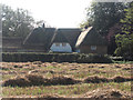
Thatch on a cottage and in the field
The cottage is on Fir Green Lane and the field separates it from Wolfhall Road.
Image: © Stuart Logan
Taken: 29 Sep 2011
0.07 miles
3
![Burbage ways [7]](https://s2.geograph.org.uk/geophotos/07/40/14/7401450_d5aef589_120x120.jpg)
Burbage ways [7]
Long Drove leaves Taskers Lane to provide access to a couple of properties before it becomes a public footpath leading to High Street near Manor Farm.
Burbage is a village in the Vale of Pewsey, Wiltshire, it lies about 5½ miles southeast of Marlborough and some 15½ miles west of Newbury. The narrow village High Street was the main north to south road from Marlborough to Andover (A346) until a bypass was built to the west in 1991. Settlement can be traced back to the Neolithic period, and Bronze Age artefacts have been found. Burbage is now essentially a commuter village.
Image: © Michael Dibb
Taken: 23 Jan 2023
0.08 miles
4
![Burbage houses [33]](https://s3.geograph.org.uk/geophotos/07/40/14/7401447_d775347c_120x120.jpg)
Burbage houses [33]
Almost hidden behind the hedge, Corner Cottage and Pipers Roost, Taskers Lane, are two attached cottages built in the 17th and early 18th century. Originally timber framed, now partly of brick and partly of flint banded with brick, all under a thatch roof. Listed, grade II, with details at: https://historicengland.org.uk/listing/the-list/list-entry/1364567
Burbage is a village in the Vale of Pewsey, Wiltshire, it lies about 5½ miles southeast of Marlborough and some 15½ miles west of Newbury. The narrow village High Street was the main north to south road from Marlborough to Andover (A346) until a bypass was built to the west in 1991. Settlement can be traced back to the Neolithic period, and Bronze Age artefacts have been found. Burbage is now essentially a commuter village.
Image: © Michael Dibb
Taken: 23 Jan 2023
0.08 miles
5
![Burbage houses [31]](https://s3.geograph.org.uk/geophotos/07/40/13/7401371_6ee0ed0d_120x120.jpg)
Burbage houses [31]
Wisteria Cottage, number 4 Eastcourt, was built, gable end to the street, in the mid to late 18th century. Constructed of diaper brick under a thatch roof. There is a rear extension. Listed, grade II, with details at: https://historicengland.org.uk/listing/the-list/list-entry/1035911
Burbage is a village in the Vale of Pewsey, Wiltshire, it lies about 5½ miles southeast of Marlborough and some 15½ miles west of Newbury. The narrow village High Street was the main north to south road from Marlborough to Andover (A346) until a bypass was built to the west in 1991. Settlement can be traced back to the Neolithic period, and Bronze Age artefacts have been found. Burbage is now essentially a commuter village.
Image: © Michael Dibb
Taken: 23 Jan 2023
0.08 miles
6
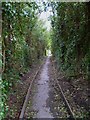
The Orange Way in Wiltshire (353)
This pathway leads from the public house to an area of green and then on to Eastcourt.
Image: © Shazz
Taken: 28 Apr 2013
0.11 miles
7
![Burbage features [8]](https://s3.geograph.org.uk/geophotos/07/40/13/7401363_91287a56_120x120.jpg)
Burbage features [8]
These attractive gates to the Old Rectory in Eastcourt are recent additions.
Burbage is a village in the Vale of Pewsey, Wiltshire, it lies about 5½ miles southeast of Marlborough and some 15½ miles west of Newbury. The narrow village High Street was the main north to south road from Marlborough to Andover (A346) until a bypass was built to the west in 1991. Settlement can be traced back to the Neolithic period, and Bronze Age artefacts have been found. Burbage is now essentially a commuter village.
Image: © Michael Dibb
Taken: 23 Jan 2023
0.11 miles
8
![Parish church [10]](https://s1.geograph.org.uk/geophotos/07/40/13/7401361_32212a25_120x120.jpg)
Parish church [10]
Part of the churchyard.
The Anglican parish church of All Saints was originally a Saxon foundation associated with the estate of Burbage. The chancel, tower and west porch of the church were rebuilt in the 14th century, the south aisle was added in the 15th century and the south porch added in the 16th century. Other than the west tower and its porch, the church was rebuilt in 1853. Constructed of flint with some limestone ashlar, the upper stage of the tower is of ashlar. The roofs are of slate and lead. Listed, grade II*, with details at: https://historicengland.org.uk/listing/the-list/list-entry/1035909
Burbage is a village in the Vale of Pewsey, Wiltshire, it lies about 5½ miles southeast of Marlborough and some 15½ miles west of Newbury. The narrow village High Street was the main north to south road from Marlborough to Andover (A346) until a bypass was built to the west in 1991. Settlement can be traced back to the Neolithic period, and Bronze Age artefacts have been found. Burbage is now essentially a commuter village.
Image: © Michael Dibb
Taken: 23 Jan 2023
0.11 miles
9
![Burbage houses [30]](https://s2.geograph.org.uk/geophotos/07/40/13/7401366_a1b5a709_120x120.jpg)
Burbage houses [30]
Numbers 12 and 14 Eastcourt were once two cottages, now one house. Built, gable end to the street, in the late 17th century of rendered stone under a thatch roof. Listed, grade II, with details at: https://historicengland.org.uk/listing/the-list/list-entry/1194382
Burbage is a village in the Vale of Pewsey, Wiltshire, it lies about 5½ miles southeast of Marlborough and some 15½ miles west of Newbury. The narrow village High Street was the main north to south road from Marlborough to Andover (A346) until a bypass was built to the west in 1991. Settlement can be traced back to the Neolithic period, and Bronze Age artefacts have been found. Burbage is now essentially a commuter village.
Image: © Michael Dibb
Taken: 23 Jan 2023
0.11 miles