1
The Orange Way in Wiltshire (354)
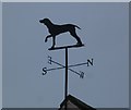
Here's a weatherdog in Burbage.
To proceed to the next section of the Orange Way go to www.geograph.org.uk/geotrips/596.
Image: © Shazz
Taken: 28 Apr 2013
0.00 miles
2
Burbage houses [29]
Numbers 22 and 24 Eastcourt are two cottages, probably originally built as one house in the early 18th century. Timber framed with wattle and daub infill, partly replaced by brick, all under a thatch roof. The building has been extended by a half bay at both ends in the 20th century. The framing is 3 panels high with straight corner braces. There are rear additions to both cottages. Listed, grade II, with details at: https://historicengland.org.uk/listing/the-list/list-entry/1364599
Burbage is a village in the Vale of Pewsey, Wiltshire, it lies about 5½ miles southeast of Marlborough and some 15½ miles west of Newbury. The narrow village High Street was the main north to south road from Marlborough to Andover (A346) until a bypass was built to the west in 1991. Settlement can be traced back to the Neolithic period, and Bronze Age artefacts have been found. Burbage is now essentially a commuter village.
Image: © Michael Dibb
Taken: 23 Jan 2023
0.00 miles
3
Church of All Saints, Burbage (3)
The church was dedicated to All Saints at least as early as 1213, maybe earlier than that. The white building beyond the entrance to the churchyard is the church hall. Next image http://www.geograph.org.uk/photo/1328746
Image: © Brian Robert Marshall
Taken: 29 May 2009
0.01 miles
4
Entrance to church, Burbage
Image: © David Martin
Taken: 25 Mar 2019
0.02 miles
5
War memorial
The Burbage war memorial is set within the churchyard of the church of All Saints. A stone cross on a tapering stone plinth, the whole set on a two-stepped stone base.
Burbage is a village in the Vale of Pewsey, Wiltshire, it lies about 5½ miles southeast of Marlborough and some 15½ miles west of Newbury. The narrow village High Street was the main north to south road from Marlborough to Andover (A346) until a bypass was built to the west in 1991. Settlement can be traced back to the Neolithic period, and Bronze Age artefacts have been found. Burbage is now essentially a commuter village.
Image: © Michael Dibb
Taken: 23 Jan 2023
0.02 miles
6
Church of All Saints, Burbage (1)
There was a priest here as far back as 1086 when the Domesday Book was published. This image shows the south-west corner of the church with the south porch also in shot. Next image http://www.geograph.org.uk/photo/1328744
Image: © Brian Robert Marshall
Taken: 29 May 2009
0.02 miles
7
Church of All Saints, Burbage (5)
In 1853 the church was comprehensively rebuilt to the extent that only the west tower and its porch pre-dated the rebuild, everything else was new. Next image http://www.geograph.org.uk/photo/1328748
Image: © Brian Robert Marshall
Taken: 29 May 2009
0.02 miles
8
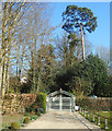
Gates to The Old Vicarage
Image: © Des Blenkinsopp
Taken: 27 Feb 2019
0.02 miles
9
Burbage, Wiltshire
The parish church of All Saints is difficult to find without an OS Map to hand - situated a little to the east of the main road through the village.
Image: © ChurchCrawler
Taken: 12 Jul 2003
0.02 miles
10
Table tomb, Church of All Saints, Burbage
The remains of Thomas and William Gale rest here. They both died in the 1830s. They may have been brothers. The tomb can be seen in context here http://www.geograph.org.uk/photo/1328748
Image: © Brian Robert Marshall
Taken: 29 May 2009
0.02 miles


![Burbage houses [29]](https://s2.geograph.org.uk/geophotos/07/40/13/7401362_abecdf0f_120x120.jpg)


