
IMAGES TAKEN NEAR TO
Baulking, FARINGDON, SN7 8NR
Introduction
This page details the photographs taken nearby to SN7 8NR by members of the Geograph project.
The Geograph project started in 2005 with the aim of publishing, organising and preserving representative images for every square kilometre of Great Britain, Ireland and the Isle of Man.

There are currently over 7.5m images from over14,400 individuals and you can help contribute to the project by visiting https://www.geograph.org.uk
Image Map
Images are licensed for reuse under creativecommons.org/licenses/by-sa/2.0
Notes
- Clicking on the map will re-center to the selected point.
- The higher the marker number, the further away the image location is from the centre of the postcode.
Image Listing (17 Images Found)
Images are licensed for reuse under creativecommons.org/licenses/by-sa/2.0
Image
Details
Distance
1
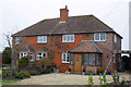
Rosey Cottage and Poppy Cottage, Baulking Lane
Poppy Cottage the right hand cottage, is #2 and had an OS cut mark benchmark on the front face but this appears to have been lost to house extension.
Image: © Roger Templeman
Taken: 2 Mar 2012
0.00 miles

3

Culvert taking stream under Baulking Lane
There is an OS benchmark Image on the top surface of the calvert above the centre of the left hand bore.
Image: © Roger Templeman
Taken: 2 Mar 2012
0.11 miles
4

Benchmark on Baulking Lane culvert
Ordnance Survey rivet benchmark described on the Bench Mark Database at http://www.bench-marks.org.uk/bm37602
Image: © Roger Templeman
Taken: 2 Mar 2012
0.11 miles
5
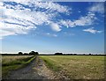
Farmland north of Baulking Grange: Sheephouse Leaze
Image: © Stefan Czapski
Taken: 5 Jul 2019
0.12 miles
6
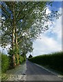
Track to Baulking Grange Farm
The farm now accommodates a riding school.
The trees are poplars.
Image: © Stefan Czapski
Taken: 5 Jul 2019
0.12 miles
7
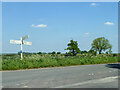
Junction on Baulking Lane
Baulking left, Stanford right and Kingston Lisle turning off.
Image: © Robin Webster
Taken: 18 May 2014
0.15 miles
8
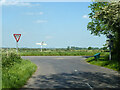
Road from Kingston Lisle meets Baulking Lane
Image: © Robin Webster
Taken: 18 May 2014
0.16 miles

10
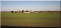
Baulking Grange Farm
A farm in the Vale of White Horse near the Stutfield Brook. Seen from a train on the railway line between Reading and Swindon.
Image: © Derek Harper
Taken: 23 Nov 2012
0.23 miles