
IMAGES TAKEN NEAR TO
Tyrell Close, FARINGDON, SN7 8EY
Introduction
This page details the photographs taken nearby to Tyrell Close, SN7 8EY by members of the Geograph project.
The Geograph project started in 2005 with the aim of publishing, organising and preserving representative images for every square kilometre of Great Britain, Ireland and the Isle of Man.

There are currently over 7.5m images from over14,400 individuals and you can help contribute to the project by visiting https://www.geograph.org.uk
Image Map
Images are licensed for reuse under creativecommons.org/licenses/by-sa/2.0
Notes
- Clicking on the map will re-center to the selected point.
- The higher the marker number, the further away the image location is from the centre of the postcode.
Image Listing (50 Images Found)
Images are licensed for reuse under creativecommons.org/licenses/by-sa/2.0
Image
Details
Distance
1
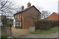
Stratford House, Faringdon Road
There is an OS benchmark Image on the blank wall of the house
Image: © Roger Templeman
Taken: 7 Feb 2012
0.05 miles
2
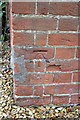
Benchmark on Stratford House, Faringdon Road
Ordnance Survey cut mark benchmark described on the Bench Mark Database at http://www.bench-marks.org.uk/bm41265
Image: © Roger Templeman
Taken: 7 Feb 2012
0.05 miles
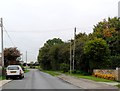
4
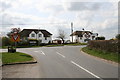
Road junction, Stanford In The Vale
Road through the village meets the A417.
Image: © andrew auger
Taken: 5 Apr 2009
0.10 miles
5
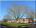
Houses on Hunters Field
Hunters Field is the name of the longest of the residential streets in the newer part of Stanford in the Vale.
Image: © Des Blenkinsopp
Taken: 7 Feb 2017
0.12 miles
6
Faringdon Road in Stanford in the Vale
Image: © Steve Daniels
Taken: 25 Jun 2014
0.13 miles
7
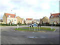
New housing in Stanford in the Vale
These houses have a wonderful view of the roundabout on the A417 as it passes the village, almost opposite Image
Image: © Jonathan Billinger
Taken: 4 Jan 2007
0.16 miles
8
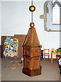
Font and play area, Church of St Denys, Stanford in The Vale
The font is Jacobean (1567-1625). The ball and chain arrangement is connected to a pulley in the roof Image with a counterweight attached so as to make it easier to raise and lower the font cover. It would be interesting to see it in action. It is always good to see facilities made available for the amusement of young parishioners. There's another example here Image
Image: © Brian Robert Marshall
Taken: 10 Nov 2010
0.17 miles
9
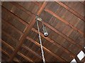
Pulley, Church of St Denys, Stanford in The Vale
The chain is connected to the font cover Image
Image: © Brian Robert Marshall
Taken: 10 Nov 2010
0.17 miles
10
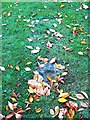
Grave, Church of St Denys, Stanford in The Vale
This heavily obscured grave is undated. According to a very informative booklet produced by students at Stanford Primary School, it consists of a 7ft. 4in. long flat stone, 2ft. 5 in. wide placed level with the ground. It is said that the representation of a 5ft. 4in. long frying pan, carved lengthwise on the face of the stone, commemorates and old gipsy woman who lost her life while at the kitchen stove. Her clothing was set alight by hot fat and the old lady died as a consequence. The stone could be a late 13th century coffin lid with an incised cross.
Image: © Brian Robert Marshall
Taken: 10 Nov 2010
0.19 miles