IMAGES TAKEN NEAR TO
Buscot Wick, FARINGDON, SN7 8DJ
Introduction
This page details the photographs taken nearby to SN7 8DJ by members of the Geograph project.
The Geograph project started in 2005 with the aim of publishing, organising and preserving representative images for every square kilometre of Great Britain, Ireland and the Isle of Man.

There are currently over 7.5m images from over14,400 individuals and you can help contribute to the project by visiting https://www.geograph.org.uk
Image Map (Loading...)


Getting Data...Please wait
Leaflet Map data © OpenStreetMap
Images are licensed for reuse under creativecommons.org/licenses/by-sa/2.0
Notes
- Clicking on the map will re-center to the selected point.
- The higher the marker number, the further away the image location is from the centre of the postcode.
Image Listing (27 Images Found)
Images are licensed for reuse under creativecommons.org/licenses/by-sa/2.0
Image
Details
Distance
1
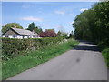
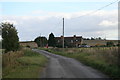
Bungalows, Buscot Wick
White bungalows beside the road in Buscot Wick.
Image: © Vieve Forward
Taken: 3 May 2014
0.04 miles
2
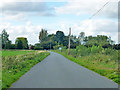
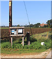
Lane approaching Buscot Wick
The sign on the right ahead announces this, together with a depiction of slow moving traffic - horses, pedestrians and tractors - and a request to drive carefully.
Image: © Robin Webster
Taken: 3 Oct 2014
0.06 miles
3
Footpath to the A417
From Buscot Wick.
Image: © andrew auger
Taken: 10 Oct 2009
0.06 miles
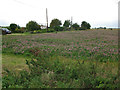
9
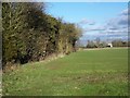
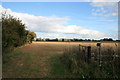
Footpath, Buscot Wick
Initially the footpath follows the hedge line as it heads for the A417.
It is difficult to date hedges unless there is documentary evidence as to their planting, but one theory is to count the species in a 30 metre stretch and each species counts as a century. Only count older plants and not saplings. The field is planted with a winter growing cereal crop.
Image: © Maigheach-gheal
Taken: 30 Jan 2010
0.13 miles
10
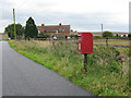
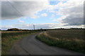
![Buscot Wick Farm [3]](https://s0.geograph.org.uk/geophotos/06/12/26/6122612_dc3faeb4_120x120.jpg)
Buscot Wick Farm [3]
The farm is seen from the bridleway which has deviated from the line of the Right of Way to avoid passing through the farm.
Image: © Michael Dibb
Taken: 3 Apr 2019
0.15 miles