IMAGES TAKEN NEAR TO
Church Close, FARINGDON, SN7 7TN
Introduction
This page details the photographs taken nearby to Church Close, SN7 7TN by members of the Geograph project.
The Geograph project started in 2005 with the aim of publishing, organising and preserving representative images for every square kilometre of Great Britain, Ireland and the Isle of Man.

There are currently over 7.5m images from over14,400 individuals and you can help contribute to the project by visiting https://www.geograph.org.uk
Image Map
Images are licensed for reuse under creativecommons.org/licenses/by-sa/2.0
Notes
- Clicking on the map will re-center to the selected point.
- The higher the marker number, the further away the image location is from the centre of the postcode.
Image Listing (84 Images Found)
Images are licensed for reuse under creativecommons.org/licenses/by-sa/2.0
Image
Details
Distance
3
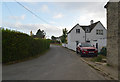
Shrivenham Road, Longcot
The road enters the village centre alongside St Mary's church.
Image: © Andrew Smith
Taken: 17 Feb 2008
0.03 miles
4
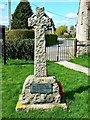
War memorial, Church of St Mary, Longcot, Oxfordshire (2)
The memorial is just inside the north gate of the churchyard. The north face of the memorial commemorates local men who fought and died in the Great War. The south face, seen here, does the same for those who fell in the Second World War.
Image: © Brian Robert Marshall
Taken: 14 Apr 2014
0.03 miles
5
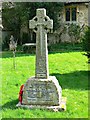
War memorial, Church of St Mary, Longcot, Oxfordshire (1)
The memorial is just inside the north gate of the churchyard. The north face of the memorial, seen here, commemorates local men who fought and died in the Great War. The south face does the same for those who fell in the Second World War.
Image: © Brian Robert Marshall
Taken: 14 Apr 2014
0.03 miles
6
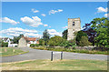
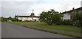
At the end of Church Close
Opposite St Mary's Church.
Image: © Des Blenkinsopp
Taken: 13 Jun 2020
0.04 miles
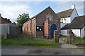
8

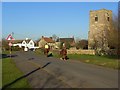
Longcot - Junction of Fernham Road and Shrivenham Road 1989
Included in shot are methodist chapel and church
Image: © Tamasine Stretton
Taken: Unknown
0.04 miles
9
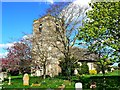
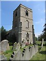
Church of St Mary, Longcot
Parts of the church date back to the 13th century although the tower is a much later 18th century addition. It was last restored in 1897. Listed Grade II* http://www.imagesofengland.org.uk/Details/Default.aspx?id=250564
Image: © Brian Robert Marshall
Taken: 14 Apr 2014
0.04 miles