
IMAGES TAKEN NEAR TO
Woolstone Road, FARINGDON, SN7 7RG
Introduction
This page details the photographs taken nearby to Woolstone Road, SN7 7RG by members of the Geograph project.
The Geograph project started in 2005 with the aim of publishing, organising and preserving representative images for every square kilometre of Great Britain, Ireland and the Isle of Man.

There are currently over 7.5m images from over14,400 individuals and you can help contribute to the project by visiting https://www.geograph.org.uk
Image Map
Images are licensed for reuse under creativecommons.org/licenses/by-sa/2.0
Notes
- Clicking on the map will re-center to the selected point.
- The higher the marker number, the further away the image location is from the centre of the postcode.
Image Listing (112 Images Found)
Images are licensed for reuse under creativecommons.org/licenses/by-sa/2.0
Image
Details
Distance
1
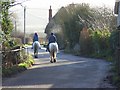
Woolstone Road, Uffington
Heading away from the village centre. In this view you just about get a hint of the downs that rise about a mile to the south.
Image: © Andrew Smith
Taken: 29 Dec 2007
0.02 miles
2
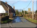
Woolstone Road, Uffington
On the left are a pair of listed cottages (Tamarisk Cottage and Birdbrook). Beyond is St Mary's church with its octagonal tower.
Image: © Andrew Smith
Taken: 29 Dec 2007
0.05 miles
3
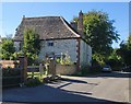
Chalk-built house at Uffington
Situated south-west of the church. Quoins and other details are of brick, but the main building material is chalk - with blocks of darker stone mixed in. As is often the case around here, the roof is tiled with stone slabs - probably quarried quite locally.
Image: © Stefan Czapski
Taken: 6 Aug 2016
0.08 miles
6
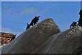
Uffington: "Animals" on a cottage thatched roof
They look real from a distance!
Image: © Michael Garlick
Taken: 27 May 2016
0.11 miles
7

Tom Brown's School Museum, Uffington
Formerly the village school. It is built largely of chalk, and dates from the first half of the 17th century (the date 1617 appears above the door). The roof is of local 'slates' - thin slabs of some local sedimentary rock, rather like the 'Horsham slates' of Sussex or the 'Collyweston slates' of the area around Stamford, Lincs.
Image: © Stefan Czapski
Taken: 23 Jul 2016
0.11 miles
8
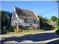
Tom Brown's School Museum, Uffington - revisited
Formerly the village school, now a museum. Thomas Hughes - the author of 'Tom Brown's School Days' - was a pupil here, hence the name. It stands at the three-went-way south of the church.
The main building material is chalk - neatly squared - though the building stands on a rubble plinth.
This image follows a rather dimly-lit one I took a couple of weeks before: http://www.geograph.org.uk/photo/5053064
Image: © Stefan Czapski
Taken: 6 Aug 2016
0.11 miles
9
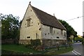
Tom Brown's School Museum
The museum is housed in the 395 year-old schoolroom that featured in Thomas Hughes’ book ‘Tom Brown’s School Days’.
Image: © Steve Daniels
Taken: 7 Aug 2013
0.11 miles
10
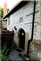
Tom Brown's School Museum entrance
The museum is housed in the 395 year-old schoolroom that featured in Thomas Hughes’ book ‘Tom Brown’s School Days’.
Image: © Steve Daniels
Taken: 7 Aug 2013
0.11 miles