IMAGES TAKEN NEAR TO
Bromsgrove, FARINGDON, SN7 7JF
Introduction
This page details the photographs taken nearby to Bromsgrove, SN7 7JF by members of the Geograph project.
The Geograph project started in 2005 with the aim of publishing, organising and preserving representative images for every square kilometre of Great Britain, Ireland and the Isle of Man.

There are currently over 7.5m images from over14,400 individuals and you can help contribute to the project by visiting https://www.geograph.org.uk
Image Map
Images are licensed for reuse under creativecommons.org/licenses/by-sa/2.0
Notes
- Clicking on the map will re-center to the selected point.
- The higher the marker number, the further away the image location is from the centre of the postcode.
Image Listing (146 Images Found)
Images are licensed for reuse under creativecommons.org/licenses/by-sa/2.0
Image
Details
Distance
1
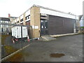
Faringdon Telephone Exchange (2)
Taken from Pulling Close, this photo shows the back and side of this TE with white BT warning notices on the corner. The numbering range of this TE is (01367) 24xxxx, the (01367) referring to the Faringdon group of eight TEs. These are pictured at https://telephone-exchanges.org.uk/exchanges/faringdon-exchanges/. A BT vehicle can be seen parked by the TE to the left of the photo.
Image: © David Hillas
Taken: 7 Mar 2023
0.05 miles
2
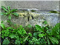
Benchmark on the Catholic Hall, Marlborough Street
Ordnance Survey 1GL cut mark benchmark described on the Bench Mark Database at http://www.bench-marks.org.uk/bm21027
Image: © Roger Templeman
Taken: 9 Oct 2010
0.05 miles
3

Marlborough Street to the left
View towards Marlborough Street in Faringdon
Image: © Bill Nicholls
Taken: 6 Aug 2019
0.06 miles
4
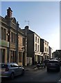
Faringdon: Marlborough Street
View south-west, the traffic getting busy on a Friday afternoon - but it was the low-angle sunlight on the buildings that caught my eye.
The building nearest the camera is the former post-office, 'ERECTED 1898'. It now houses a pizza restaurant.
Image: © Stefan Czapski
Taken: 19 Oct 2018
0.07 miles
5
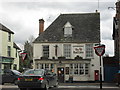
The Red Lion, Faringdon
In the centre of the town.
Image: © andrew auger
Taken: 1 Apr 2010
0.07 miles
6
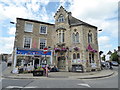
The Corn Exchange, Faringdon
With the Acacia charity shop on the right.
Image: © Vieve Forward
Taken: 7 Jul 2019
0.08 miles
7
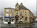
Faringdon - Cornmarket
Corn Exchange (Old Council Chambers building built 1863) on the Cornmarket in Faringdon town centre. Adjacent to it here (2023) is an Acacia UK charity shop.
www.faringdontowncouncil.gov.uk
Image: © Colin Smith
Taken: 5 Aug 2023
0.08 miles
8
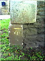
Benchmark on the Baptist Church, Bromsgrove
Ordnance Survey cut mark benchmark described on the Bench Mark Database at http://www.bench-marks.org.uk/bm35704
Image: © Roger Templeman
Taken: 9 Oct 2010
0.08 miles
9
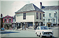
Faringdon: Old Town Hall and Old Crown Inn, 1962
Not a lot different 50 years later. NOT my car in foreground
Image: © Ben Brooksbank
Taken: 31 May 1962
0.08 miles