IMAGES TAKEN NEAR TO
Russell Walk, FARINGDON, SN7 7ET
Introduction
This page details the photographs taken nearby to Russell Walk, SN7 7ET by members of the Geograph project.
The Geograph project started in 2005 with the aim of publishing, organising and preserving representative images for every square kilometre of Great Britain, Ireland and the Isle of Man.

There are currently over 7.5m images from over14,400 individuals and you can help contribute to the project by visiting https://www.geograph.org.uk
Image Map
Images are licensed for reuse under creativecommons.org/licenses/by-sa/2.0
Notes
- Clicking on the map will re-center to the selected point.
- The higher the marker number, the further away the image location is from the centre of the postcode.
Image Listing (95 Images Found)
Images are licensed for reuse under creativecommons.org/licenses/by-sa/2.0
Image
Details
Distance
1
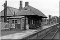
Faringdon station,1950
View SE, towards Uffington: terminus of ex-GWR branch from the main line there, closed to passengers 29/12/51, goods 1/7/63.
Image: © Walter Dendy, deceased
Taken: 24 Sep 1950
0.11 miles
2
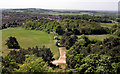
View West from The Folly
Looking westwards from the top of the tower out over Faringdon town with Badbury Hill in the distance.
Image: © Des Blenkinsopp
Taken: 2 May 2011
0.12 miles
3
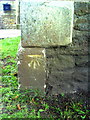
Benchmark on the Baptist Church, Bromsgrove
Ordnance Survey cut mark benchmark described on the Bench Mark Database at http://www.bench-marks.org.uk/bm35704
Image: © Roger Templeman
Taken: 9 Oct 2010
0.12 miles
4
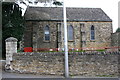
Faringdon Baptist Church, Bromsgrove face
Now doubles as a day centre. There is an OS benchmark Image on the front left corner of the church immediately left of the red railings
Image: © Roger Templeman
Taken: 18 Oct 2013
0.13 miles
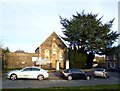
6
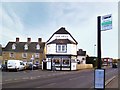
Faringdon Brewery at The Swan
Brewpub on Station Road.
Image: © Des Blenkinsopp
Taken: 18 Nov 2012
0.13 miles
7
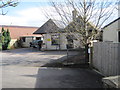
Faringdon railway station (site), Oxfordshire
Opened in 1864 by the Faringdon Railway at the end of the short branch from Uffington, this station closed to passengers in 1951 and completely in 1964. The line became part of the Great Western Railway in 1886.
View south east from the boundary and the approximate position of the buffers. The single platform was to the right of the building.
Image: © Nigel Thompson
Taken: 8 Feb 2014
0.14 miles
8
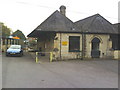
The Old Station Nursery, Park Road
As the name implies, this was Faringdon Station, which was at the end of a branch line from Uffington.
Image: © Roger Templeman
Taken: 9 Oct 2010
0.14 miles
9
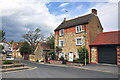
Three storeyed brick and stone house - Faringdon
Image: © Mick Lobb
Taken: 12 May 2010
0.15 miles