
IMAGES TAKEN NEAR TO
Station Road, SWINDON, SN6 8GG
Introduction
This page details the photographs taken nearby to Station Road, SN6 8GG by members of the Geograph project.
The Geograph project started in 2005 with the aim of publishing, organising and preserving representative images for every square kilometre of Great Britain, Ireland and the Isle of Man.

There are currently over 7.5m images from over14,400 individuals and you can help contribute to the project by visiting https://www.geograph.org.uk
Image Map
Images are licensed for reuse under creativecommons.org/licenses/by-sa/2.0
Notes
- Clicking on the map will re-center to the selected point.
- The higher the marker number, the further away the image location is from the centre of the postcode.
Image Listing (17 Images Found)
Images are licensed for reuse under creativecommons.org/licenses/by-sa/2.0
Image
Details
Distance
1
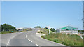
Building by the new bridge
A new bridge has been built over the railway as part of the electrification works. The old Shrivenham station was here together with a small cluster of buildings and businesses nearby. Another one is nearing completion.
Image: © Des Blenkinsopp
Taken: 24 Jun 2020
0.01 miles
2
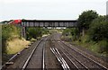
Station Road Bridge at Shrivenham
Shrivenham Station was the other side of the bridge. It was demolished in 1965.
Image: © Steve Daniels
Taken: 2 Sep 2009
0.03 miles
5
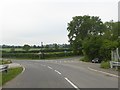
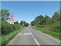
Junction of Avenue Road with B4000, Station Road, Shrivenham
Image: © David Smith
Taken: 9 Jun 2018
0.05 miles

9
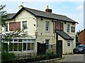
The Fat Dog, Shrivenham
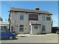
The pub and restaurant closed its doors for the last time on 20 December 2012 because, according to its Facebook page, 'due to the economic climate maintaining the business is no longer viable'. Its relatively remote location about a kilometre south of the nearest village probably didn't help. Old maps show that the pub was once known as the Victoria Hotel as far back as the 19th century. The property could well end up as a house if it isn't firebombed first.
Image: © Brian Robert Marshall
Taken: 8 Aug 2013
0.09 miles
10
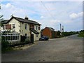
The Fat Dog and the B4000, Shrivenham
Looking a bit unloved, the apparently once-popular pub and restaurant is now closed and empty. A Facebook message from the last licensees indicates that the premises closed on 20 December 2012 because 'due to the economic climate maintaining the business is no longer viable'. If it isn't torched first it may become a dwelling house. The B4000, also called Station Road, can be seen as it leads north towards Shrivenham.
Image: © Brian Robert Marshall
Taken: 8 Aug 2013
0.09 miles