
IMAGES TAKEN NEAR TO
Penny Close, SWINDON, SN6 8GA
Introduction
This page details the photographs taken nearby to Penny Close, SN6 8GA by members of the Geograph project.
The Geograph project started in 2005 with the aim of publishing, organising and preserving representative images for every square kilometre of Great Britain, Ireland and the Isle of Man.

There are currently over 7.5m images from over14,400 individuals and you can help contribute to the project by visiting https://www.geograph.org.uk
Image Map
Images are licensed for reuse under creativecommons.org/licenses/by-sa/2.0
Notes
- Clicking on the map will re-center to the selected point.
- The higher the marker number, the further away the image location is from the centre of the postcode.
Image Listing (53 Images Found)
Images are licensed for reuse under creativecommons.org/licenses/by-sa/2.0
Image
Details
Distance
1
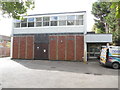
Shrivenham Telephone Exchange (1)
Situated in Faringdon Road, this TE dates from the early 1970s and replaced a smaller TE in nearby Watchfield, http://www.geograph.org.uk/photo/1557530 refers. A BT Openreach van can be seen parked to the right of the photo.
Image: © David Hillas
Taken: 9 Sep 2017
0.15 miles
2
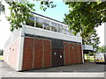
Shrivenham Telephone Exchange (2)
This TE, in Faringdon Road, has the code SSSHR and provides telephone and broadband services to 2,087 residential and 129 non-residential premises in Shrivenham plus Bourton, Longcot and Watchfield nearby. It has the numbering range (01793) 78xxxx, the (01793) referring to the Swindon group of fifteen TEs, and its postcode is SN6 8AJ.
Image: © David Hillas
Taken: 9 Sep 2017
0.15 miles
5
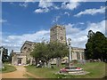
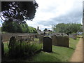
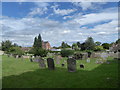
St Andrew, Shrivenham: early August 2020
Image: © Basher Eyre
Taken: 5 Aug 2020
0.16 miles
6
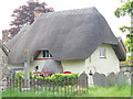
Thatched Cottage, Shrivenham
Chocolate box, pastel-shaded, thatched cottage adjacent to the parish church.
http://www.shrivenham.org/home.html
Image: © Colin Smith
Taken: 21 May 2008
0.17 miles
7
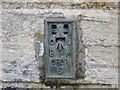
Ordnance Survey Flush Bracket S0808
This bracket can be found on the wall of St Andre's Church at Shrivenham.
For more detail see : http://www.bench-marks.org.uk/bm12137
Image: © Peter Wood
Taken: 11 Feb 2017
0.18 miles
8
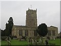
The Church of St Andrew at Shrivenham
Viewed from the north-east.
Image: © Peter Wood
Taken: 11 Feb 2017
0.18 miles
9
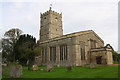
St Andrew's Church
An OS flush bracket benchmark Image can be seen at the near angle of the church between the railings and a downpipe. The vane on the tower is an OS intersected station trig point, http://www.trigpointinguk.com/trigs/trig-details.php?t=12654
Image: © Roger Templeman
Taken: 18 Oct 2013
0.18 miles
10
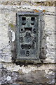
Benchmark on St Andrew's Church
Ordnance Survey flush bracket benchmark (serial number S0808) described on the Bench Mark Database at http://www.bench-marks.org.uk/bm12137
Image: © Roger Templeman
Taken: 18 Oct 2013
0.18 miles