
IMAGES TAKEN NEAR TO
Kitefield, SWINDON, SN6 6NF
Introduction
This page details the photographs taken nearby to Kitefield, SN6 6NF by members of the Geograph project.
The Geograph project started in 2005 with the aim of publishing, organising and preserving representative images for every square kilometre of Great Britain, Ireland and the Isle of Man.

There are currently over 7.5m images from over14,400 individuals and you can help contribute to the project by visiting https://www.geograph.org.uk
Image Map
Images are licensed for reuse under creativecommons.org/licenses/by-sa/2.0
Notes
- Clicking on the map will re-center to the selected point.
- The higher the marker number, the further away the image location is from the centre of the postcode.
Image Listing (56 Images Found)
Images are licensed for reuse under creativecommons.org/licenses/by-sa/2.0
Image
Details
Distance
1
![A circular walk around Cricklade [4]](https://s1.geograph.org.uk/geophotos/06/33/74/6337429_0d52d30b_120x120.jpg)
A circular walk around Cricklade [4]
The path, here part of two long distance paths - the Thames Path and the Thames and Severn Way runs straight across the field.
Starting in the town of Cricklade, the walk passes through Latton and Eysey before following the River Thames back to Cricklade.
Image: © Michael Dibb
Taken: 25 Aug 2019
0.05 miles
2
![A circular walk around Cricklade [5]](https://s2.geograph.org.uk/geophotos/06/33/74/6337430_9156c2e7_120x120.jpg)
A circular walk around Cricklade [5]
The path, here part of two long distance paths - the Thames Path and the Thames and Severn Way - runs through the gate into Bailiffe Piece, part of a housing development on the northern edge of Cricklade.
Starting in the town of Cricklade, the walk passes through Latton and Eysey before following the River Thames back to Cricklade.
Image: © Michael Dibb
Taken: 25 Aug 2019
0.05 miles
3
![A circular walk around Cricklade [6]](https://s1.geograph.org.uk/geophotos/06/33/74/6337433_30673d77_120x120.jpg)
A circular walk around Cricklade [6]
The path, here part of two long distance paths - the Thames Path and the Thames and Severn Way - runs through Bailiffe Piece, part of a housing development on the northern edge of Cricklade.
Starting in the town of Cricklade, the walk passes through Latton and Eysey before following the River Thames back to Cricklade.
Image: © Michael Dibb
Taken: 25 Aug 2019
0.08 miles
4
![A circular walk around Cricklade [3]](https://s2.geograph.org.uk/geophotos/06/33/74/6337426_2a64308e_120x120.jpg)
A circular walk around Cricklade [3]
The path towards the River Thames continues straight ahead, part of two long distance paths - the Thames Path and the Thames and Severn Way. The footpath to the left, through the kissing gate leads into the centre of Cricklade.
Starting in the town of Cricklade, the walk passes through Latton and Eysey before following the River Thames back to Cricklade.
Image: © Michael Dibb
Taken: 25 Aug 2019
0.12 miles
5
![A circular walk around Cricklade [7]](https://s2.geograph.org.uk/geophotos/06/33/74/6337434_24f5dbcd_120x120.jpg)
A circular walk around Cricklade [7]
The path, here part of two long distance paths - the Thames Path and the Thames and Severn Way - runs across the field towards the poplars.
Starting in the town of Cricklade, the walk passes through Latton and Eysey before following the River Thames back to Cricklade.
Image: © Michael Dibb
Taken: 25 Aug 2019
0.13 miles
6
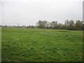
Open country just north of Cricklade
Much used by local dog walkers. The infant River Thames is not far away (200 metres or so) but cannot be seen from this angle.
Image: © David Purchase
Taken: 1 Nov 2016
0.14 miles
7
![A circular walk around Cricklade [8]](https://s3.geograph.org.uk/geophotos/06/33/74/6337435_4db5b8e5_120x120.jpg)
A circular walk around Cricklade [8]
The path, here part of two long distance paths - the Thames Path and the Thames and Severn Way - heads past Quendale House towards West Mill Lane and the River Thames.
Starting in the town of Cricklade, the walk passes through Latton and Eysey before following the River Thames back to Cricklade.
Image: © Michael Dibb
Taken: 25 Aug 2019
0.15 miles
9
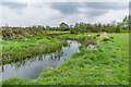
River Thames
The River Thames (or Isis) as it passes North Meadow in Cricklade.
Image: © Ian Capper
Taken: 2 May 2022
0.17 miles
10
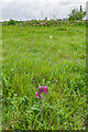
North Meadow
A trio of Snake's-head Fritillary (Fritillaria meleagris) flowers at North Meadow in Cricklade, one of its key sites in the UK. In the background is the tower of St Sampson's Church, Cricklade.
Image: © Ian Capper
Taken: 2 May 2022
0.17 miles