IMAGES TAKEN NEAR TO
Chelworth Road, SWINDON, SN6 6JD
Introduction
This page details the photographs taken nearby to Chelworth Road, SN6 6JD by members of the Geograph project.
The Geograph project started in 2005 with the aim of publishing, organising and preserving representative images for every square kilometre of Great Britain, Ireland and the Isle of Man.

There are currently over 7.5m images from over14,400 individuals and you can help contribute to the project by visiting https://www.geograph.org.uk
Image Map
Images are licensed for reuse under creativecommons.org/licenses/by-sa/2.0
Notes
- Clicking on the map will re-center to the selected point.
- The higher the marker number, the further away the image location is from the centre of the postcode.
Image Listing (9 Images Found)
Images are licensed for reuse under creativecommons.org/licenses/by-sa/2.0
Image
Details
Distance
1
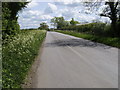
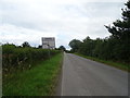
Road heading up to Cross Roads Farm
Road heading up to Cross Roads Farm to join the Malmesbury Road
Image: © Shaun Ferguson
Taken: 15 May 2010
0.03 miles
2
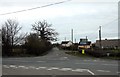
Crossroads by Chelworth Upper Green
A minor road crosses the B4040.
Image: © Steve Daniels
Taken: 14 Apr 2013
0.05 miles
3
Crossroads, near Chelworth
The minor road from Waterhay approaches the junction with the Malmesbury Road, beyond which is Chelworth.
Image: © Vieve Forward
Taken: 16 Jun 2014
0.05 miles
4
Chelworth Crossroads
View down the road towards Upper Chelworth Farm.
Image: © Wayland Smith
Taken: 25 May 2020
0.05 miles
6
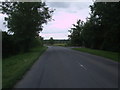
Approaching Chelworth Crossroads
Minor road towards the B4040.
Image: © JThomas
Taken: 11 Jul 2019
0.10 miles
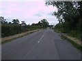
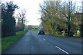
7
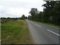
Malmesbury Road outside Cricklade
The Malmesbury Road descends a hill shortly after leaving Cricklade. The entrance to Integer Park is on the right.
Image: © Vieve Forward
Taken: 16 Jun 2014
0.18 miles
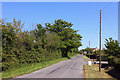
9
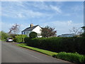
B4040 Malmesbury Road heading west
Passing Chelworth Fields Livery Yard.
Image: © Robin Webster
Taken: 9 Jan 2022
0.25 miles