
IMAGES TAKEN NEAR TO
Cricklade, SWINDON, SN6 6HY
Introduction
This page details the photographs taken nearby to SN6 6HY by members of the Geograph project.
The Geograph project started in 2005 with the aim of publishing, organising and preserving representative images for every square kilometre of Great Britain, Ireland and the Isle of Man.

There are currently over 7.5m images from over14,400 individuals and you can help contribute to the project by visiting https://www.geograph.org.uk
Image Map
Images are licensed for reuse under creativecommons.org/licenses/by-sa/2.0
Notes
- Clicking on the map will re-center to the selected point.
- The higher the marker number, the further away the image location is from the centre of the postcode.
Image Listing (4 Images Found)
Images are licensed for reuse under creativecommons.org/licenses/by-sa/2.0
Image
Details
Distance
1
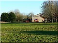
Bridleway to Whitehall Farm, Cricklade
The farm is viewed from a bridleway that runs through the viewpoint towards the farm, then through it to the minor road between Cricklade and Purton Stoke.
Image: © Brian Robert Marshall
Taken: 20 Jan 2011
0.05 miles
2

Field near Chelworth Lower Green
Two bridleways cross this field. The more westerly one provides the viewpoint towards the Saxon town of Cricklade with its distinctive church of St Sampson visible to the left at SU099935.
Image: © Brian Robert Marshall
Taken: 20 Jan 2011
0.11 miles
3

Large puddle and a field near Cricklade
The weather for the last few days has been cold and clear thanks to an area of high pressure over the UK. Before that there had been a period of wet and mild weather. The resulting puddle has frozen. A bridleway crosses the field from south to north a few metres from the viewpoint but it is not well-defined.
Image: © Brian Robert Marshall
Taken: 20 Jan 2011
0.14 miles
4
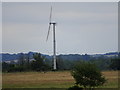
Wind turbine near Whitehall Farm, Cricklade
The two-blade turbine is about 1400 metres east of the viewpoint at RAF Blakehill nature reserve. Even further away is the rather larger Westmill wind farm at Watchfield about 15 kilometres further on Image
Image: © Brian Robert Marshall
Taken: 8 Jul 2020
0.15 miles