
IMAGES TAKEN NEAR TO
Cirencester Road, SWINDON, SN6 6DW
Introduction
This page details the photographs taken nearby to Cirencester Road, SN6 6DW by members of the Geograph project.
The Geograph project started in 2005 with the aim of publishing, organising and preserving representative images for every square kilometre of Great Britain, Ireland and the Isle of Man.

There are currently over 7.5m images from over14,400 individuals and you can help contribute to the project by visiting https://www.geograph.org.uk
Image Map
Images are licensed for reuse under creativecommons.org/licenses/by-sa/2.0
Notes
- Clicking on the map will re-center to the selected point.
- The higher the marker number, the further away the image location is from the centre of the postcode.
Image Listing (5 Images Found)
Images are licensed for reuse under creativecommons.org/licenses/by-sa/2.0
Image
Details
Distance
1
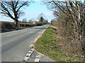
Cirencester Road, Latton
This is an old Roman road originally known as Ermin Street. It is now a local through road serving the village of Latton. Not so many years back this was the main link between the M5 and M4. That function has been taken over by the bypass to the west of here. The northern gridline is about 180 metres away from the viewpoint.
Image: © Brian Robert Marshall
Taken: 4 Mar 2008
0.11 miles
2
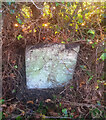
Old Milestone, Westfield Farm, Ermin Street
In the parish of Latton, on the SW side of Ermin Street (Roman Road).
Erected by the Cirencester and Cricklade Turnpike Trust in the 19ᵗʰ century.
An image of the original plate can be seen at Image
Inscription (was): Cirencᴿ. / 5 / Crickᴱ. / 2
Milestone Society National ID: GL_CICK05
Image: © Tom Blanden
Taken: 5 Dec 2022
0.19 miles
3
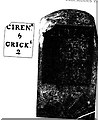
Old Milestone
Metal plate attached to stone post by the UC road (was A419), in parish of LATTON (NORTH WILTSHIRE District), Ermin Street, by Westfield Farm, by the road, on SW side of road. Cricklade iron plate Erected by the Cirencester & Cricklade turnpike trust in the 19th century.
Inscription reads:- : CIREN.R / 5 / CRICK.E / 2 / : : : . ; .
Listed.
Milestone Society National ID: WI_CICK05.
Image: © JM Weightmann
Taken: 1 Oct 2000
0.19 miles
4
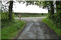
Road junction at Latton
Road junction at Latton near Malvern.
Image: © Philip Halling
Taken: 3 May 2022
0.21 miles
5
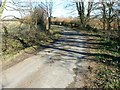
Croft Lane, Latton
This little lane leads off the old Roman road and twists and turns until it reaches St John the Baptist church in the next square east.
Image: © Brian Robert Marshall
Taken: 4 Mar 2008
0.24 miles