
IMAGES TAKEN NEAR TO
Bath Road, SWINDON, SN6 6AT
Introduction
This page details the photographs taken nearby to Bath Road, SN6 6AT by members of the Geograph project.
The Geograph project started in 2005 with the aim of publishing, organising and preserving representative images for every square kilometre of Great Britain, Ireland and the Isle of Man.

There are currently over 7.5m images from over14,400 individuals and you can help contribute to the project by visiting https://www.geograph.org.uk
Image Map
Images are licensed for reuse under creativecommons.org/licenses/by-sa/2.0
Notes
- Clicking on the map will re-center to the selected point.
- The higher the marker number, the further away the image location is from the centre of the postcode.
Image Listing (372 Images Found)
Images are licensed for reuse under creativecommons.org/licenses/by-sa/2.0
Image
Details
Distance
1
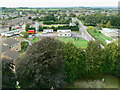
View west-north-west from St Sampson's tower, Cricklade
The complex in the centre is Cricklade Fire Station. Behind the fire station is what looks like 1970s local authority housing.
Image: © Brian Robert Marshall
Taken: 6 Sep 2009
0.01 miles
2
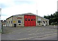
Cricklade Fire Station, Bath Road
The fire service in Wiltshire comes under Wiltshire Fire & Rescue Service, whose HQ is at Potterne, near Devizes. The Cricklade Fire Station was opened in 1963, the same year, by co-incidence, when Cricklade Railway Station finally closed to freight traffic; the passenger service having ceased in 1961.
Image
Image: © P L Chadwick
Taken: 26 Sep 2010
0.01 miles
3
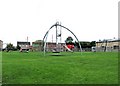
Recreation ground (1), Bath Road
This recreation ground for children, has been provided with various items of play equipment to keep them amused. However the Fire Station drill tower in the background is not one of them!
Image
Image: © P L Chadwick
Taken: 26 Sep 2010
0.01 miles
4
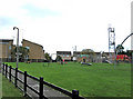
Recreation ground (2), Bath Road
Another view of this recreation ground, located between the Parish Church and the Fire Station.
Image
Image: © P L Chadwick
Taken: 26 Sep 2010
0.01 miles
5
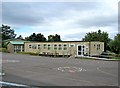
St. Sampson's Church of England Schools, Bath Road
There is both a junior school and an infants' school on this site. The school was originally built in 1959, and took children from 5 to 11 years old. Because of the expansion of Cricklade, the school was divided into two in 1979. It was also necessary in the 1970's to add mobile classrooms, of which this would appear to be one. The schools are now spread across several buildings, of which this of course is just one.
Image: © P L Chadwick
Taken: 26 Sep 2010
0.02 miles
6
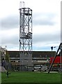
Cricklade Fire Station drill tower, Bath Road
Next to the Fire Station is the drill tower.
Image
Image: © P L Chadwick
Taken: 26 Sep 2010
0.02 miles
7
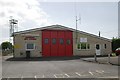
Cricklade Fire Station
Cricklade Fire Station, Bath Road, Cricklade, Wiltshire
Image: © Kevin Hale
Taken: 8 May 2007
0.02 miles
8

Cemetery wall benchmark
A cutmark, as listed in the Benchmark Database: https://www.bench-marks.org.uk/bm49595 , on the wall outside the cemetery. See Image] for a location view.
Image: © Neil Owen
Taken: 20 May 2025
0.04 miles
9

Cricklade cemetery along Bath Road
The town's cemetery bears a benchmark on the pier. See Image
Image: © Neil Owen
Taken: 20 May 2025
0.04 miles
10
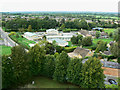
View north-north-west from St Sampson's tower, Cricklade
The primary subject of this image is St Sampson's C of E Primary School. The road is Bath Road.
Image: © Brian Robert Marshall
Taken: 6 Sep 2009
0.05 miles