
IMAGES TAKEN NEAR TO
Tidworth Close, SWINDON, SN5 8ZH
Introduction
This page details the photographs taken nearby to Tidworth Close, SN5 8ZH by members of the Geograph project.
The Geograph project started in 2005 with the aim of publishing, organising and preserving representative images for every square kilometre of Great Britain, Ireland and the Isle of Man.

There are currently over 7.5m images from over14,400 individuals and you can help contribute to the project by visiting https://www.geograph.org.uk
Image Map
Images are licensed for reuse under creativecommons.org/licenses/by-sa/2.0
Notes
- Clicking on the map will re-center to the selected point.
- The higher the marker number, the further away the image location is from the centre of the postcode.
Image Listing (81 Images Found)
Images are licensed for reuse under creativecommons.org/licenses/by-sa/2.0
Image
Details
Distance
1
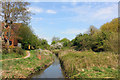
River Ray
Nature reserve at Rushey Platt.
Image: © Wayland Smith
Taken: 12 Apr 2020
0.06 miles
2
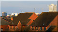
Houses, near Wootton Bassett Road, Swindon
I should know the name of this estate but for the moment I've forgotten it. It dates to the 1990s and the roads therein commemorate the Normandy invasion of 1944 with names such as 'Juno', 'Sword', 'Caen' and 'Utah'.
Image: © Brian Robert Marshall
Taken: 19 Feb 2010
0.07 miles
3
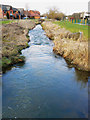
The River Ray, Swindon
The river is a small tributary of the Thames into which it drains in the vicinity of Cricklade.
Image: © Brian Robert Marshall
Taken: 19 Feb 2010
0.07 miles
4
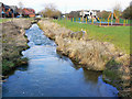
The River Ray near the Wilts and Berks canal, Swindon
The River Ray is one of two small rivers that drain into the Thames in the Cricklade area. The housing area to the left is fairly recent.
Image: © Brian Robert Marshall
Taken: 19 Feb 2010
0.07 miles
5
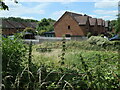
Houses in Rhine Close, Swindon
Near the southern edge of the town.
Image: © Christine Johnstone
Taken: 14 Jul 2022
0.08 miles
6
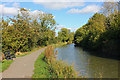
Swindon Old Canal
Near the end of the Old Canal behind St Margaret's Way.
Image: © Wayland Smith
Taken: 16 Oct 2011
0.09 miles
7
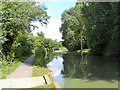
Wilts & Berks Canal in Summer
Looks like a rural scene but is actually in suburban Swindon!
Image: © Colin Bews
Taken: 27 Jul 2014
0.09 miles
8
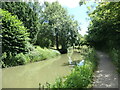
Bend on the Wilts & Berks canal
Near Rushey Platt nature reserve. The Wilts & Berks canal opened in 1810, linking the Kennet & Avon canal with the River Thames and running right through Swindon. It closed in 1914, but is now partly restored.
Image: © Christine Johnstone
Taken: 14 Jul 2022
0.10 miles
9
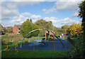
Sitting on a Swing
A guy happily swinging around messing about with his phone in a kids' playground.
He looked about 25.
Image: © Des Blenkinsopp
Taken: 17 Oct 2022
0.10 miles
10
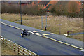
Motorcyclist, Redposts Drive, Swindon
The Redposts Drive extension seen in this image Image is still not open to through traffic so it is safe enough for a learner rider to hone his riding skills. The bridge can also be seen in this image Image
Image: © Brian Robert Marshall
Taken: 19 Feb 2010
0.12 miles