
IMAGES TAKEN NEAR TO
Westlea Drive, SWINDON, SN5 7AN
Introduction
This page details the photographs taken nearby to Westlea Drive, SN5 7AN by members of the Geograph project.
The Geograph project started in 2005 with the aim of publishing, organising and preserving representative images for every square kilometre of Great Britain, Ireland and the Isle of Man.

There are currently over 7.5m images from over14,400 individuals and you can help contribute to the project by visiting https://www.geograph.org.uk
Image Map
Images are licensed for reuse under creativecommons.org/licenses/by-sa/2.0
Notes
- Clicking on the map will re-center to the selected point.
- The higher the marker number, the further away the image location is from the centre of the postcode.
Image Listing (34 Images Found)
Images are licensed for reuse under creativecommons.org/licenses/by-sa/2.0
Image
Details
Distance
1
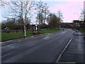
Westlea Drive, West Swindon
Showing a playground on the left, and typical housing on the right.
Image: © Vieve Forward
Taken: 30 Dec 2012
0.10 miles
2
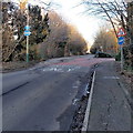
Buses only, Mannington Lane, Swindon
BUSES ONLY is painted on the road surface, but the sign on the left
shows that bicycles (and pedestrians) are also allowed.
Image: © Jaggery
Taken: 2 Feb 2013
0.11 miles
3
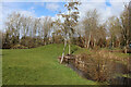
Westlea Park
Small lake in Westlea Park.
Image: © Wayland Smith
Taken: 13 Mar 2021
0.12 miles
4
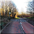
Cycle route crosses Mannington Lane, Swindon
The broken white lines mark the cycle route across the road.
Image: © Jaggery
Taken: 2 Feb 2013
0.12 miles
5
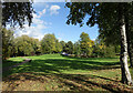
Westlea Park
Trees and lawns and a playground in the midst of all the houses.
Image: © Des Blenkinsopp
Taken: 17 Oct 2022
0.12 miles
6
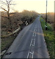
A view east along Tewkesbury Drive, Swindon
Viewed from this http://www.geograph.org.uk/photo/3413487 footbridge, looking past a bus stop,
in the direction of the roundabout at the A3102 junction.
Image: © Jaggery
Taken: 2 Feb 2013
0.12 miles
7

Intergraph (west), Delta Business Park, Swindon (2)
Intergraph are a high-tech company who are 'a leading global provider of spatial information management (SIM) software' according to their website. I think that's something to do with geographical information systems. They have two buildings here, one on either side of the road and facing each other.
Image: © Brian Robert Marshall
Taken: 30 Oct 2007
0.13 miles
8

Intergraph (west), Delta Business Park, Swindon (4)
Intergraph are a high-tech company who are 'a leading global provider of spatial information management (SIM) software' according to their website. I think that's something to do with geographical information systems. They have two buildings here, one on either side of the road and facing each other.
Image: © Brian Robert Marshall
Taken: 30 Oct 2007
0.13 miles
9

Intergraph (west), Delta Business Park, Swindon (3)
Intergraph are a high-tech company who are 'a leading global provider of spatial information management (SIM) software' according to their website. I think that's something to do with geographical information systems. They have two buildings here, one on either side of the road and facing each other. The other building can be seen reflected in this one.
Image: © Brian Robert Marshall
Taken: 30 Oct 2007
0.16 miles
10
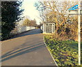
Tewkesbury Drive footbridge, Swindon
The footbridge over the B4553 Tewkesbury Drive connects
the Toothill district on this side with Westlea on the far side.
Image: © Jaggery
Taken: 2 Feb 2013
0.16 miles