IMAGES TAKEN NEAR TO
Woollaton Close, SWINDON, SN5 6BB
Introduction
This page details the photographs taken nearby to Woollaton Close, SN5 6BB by members of the Geograph project.
The Geograph project started in 2005 with the aim of publishing, organising and preserving representative images for every square kilometre of Great Britain, Ireland and the Isle of Man.

There are currently over 7.5m images from over14,400 individuals and you can help contribute to the project by visiting https://www.geograph.org.uk
Image Map
Images are licensed for reuse under creativecommons.org/licenses/by-sa/2.0
Notes
- Clicking on the map will re-center to the selected point.
- The higher the marker number, the further away the image location is from the centre of the postcode.
Image Listing (10 Images Found)
Images are licensed for reuse under creativecommons.org/licenses/by-sa/2.0
Image
Details
Distance
1
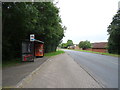
Bus stop and shelter on Whitehill Way, Swindon
Image: © JThomas
Taken: 14 Jul 2019
0.06 miles
3
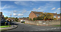
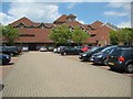
Castle Dore, Swindon
Another of the many residential no through roads which make up this area.
Image: © Des Blenkinsopp
Taken: 17 Oct 2022
0.13 miles
6
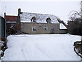
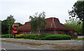
Whitehill Farm, Beaumaris Road, Swindon
In the 17th century, Whitehill Farm was a 65-acre dairy farm. Then, together with Mannington and Toothill Farms, it was bought by Thomas Sutton, and formed part of the Charterhouse estate in Lydiard Tregoze. The rents from the tenant farmers went to fund Charterhouse School, which started as a charitable venture for the education of poor boys. In 1919, the three farms were sold to Wiltshire County Council and broken up into smallholdings for the use of ex-servicemen returning from WWI. In the 1970s, they were engulfed by modern housing after westward expansion of Swindon was approved. Whitehill Farmhouse is now a Swindon Borough Council property.
Image: © Vieve Forward
Taken: 12 Feb 2012
0.23 miles
7
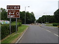
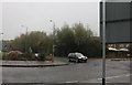
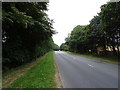
Whitehill Way, Swindon
Approaching a roundabout on the B4534.
Image: © JThomas
Taken: 14 Jul 2019
0.23 miles
8
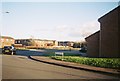
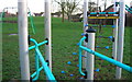
Rowton Heath Way
Taken February 2015 on 35mm Kodak film.
Image: © Robert Gourley
Taken: Unknown
0.23 miles