
IMAGES TAKEN NEAR TO
Badgers Brook, SWINDON, SN4 9DG
Introduction
This page details the photographs taken nearby to Badgers Brook, SN4 9DG by members of the Geograph project.
The Geograph project started in 2005 with the aim of publishing, organising and preserving representative images for every square kilometre of Great Britain, Ireland and the Isle of Man.

There are currently over 7.5m images from over14,400 individuals and you can help contribute to the project by visiting https://www.geograph.org.uk
Image Map
Images are licensed for reuse under creativecommons.org/licenses/by-sa/2.0
Notes
- Clicking on the map will re-center to the selected point.
- The higher the marker number, the further away the image location is from the centre of the postcode.
Image Listing (77 Images Found)
Images are licensed for reuse under creativecommons.org/licenses/by-sa/2.0
Image
Details
Distance
1
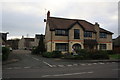
Ely Court
Ely Court is a development of flats on the site of the former "Wroughton" public house which was previously the Whitbread, and before that West Country Brewery, Stroud, public house "The Ely". The name is pronounced "EELIGH" not as the Cambridgeshire city and referred to a famous racehorse trained in the village in the 1830s and 40s. The flats used the paddocks behind the pub, whilst the pub building itself is substantially the same as it was but converted to accommodation. The Public Bar was on the right and the lounge on the left. My local in the late 60s and 70s.
Image: © John Stephen
Taken: 19 Dec 2015
0.10 miles
2
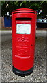
Elizabeth II postbox on the A4361 Wroughton
Outside the Post Office.
Postbox No. SN4 144.
Image: © JThomas
Taken: 13 Jul 2019
0.10 miles
3
![Wroughton houses [19]](https://s0.geograph.org.uk/geophotos/06/42/23/6422372_eb27f6a4_120x120.jpg)
Wroughton houses [19]
Hidden behind the fence are numbers 13, 14 and 15 high Street with number 13 at the rear of number 14. Built circa 1800 with alteration in the mid 19th century. Listed, grade II, with details at: https://historicengland.org.uk/listing/the-list/list-entry/1185670
The large village of Wroughton lies 2 miles south of Swindon at the foot of the Marlborough Downs escarpment. Two headstreams of the River Ray flow from the downs and meet in the village to run north as Wroughton Stream. There is much evidence of settlement and intensive farming of the area in the Roman period. Originally an agricultural village, most workers now commute into Swindon.
Image: © Michael Dibb
Taken: 11 Mar 2020
0.11 miles
4
![Wroughton houses [17]](https://s0.geograph.org.uk/geophotos/06/42/17/6421716_52e65baf_120x120.jpg)
Wroughton houses [17]
Fairwater House, built circa 1700, was the centre of a racehorse training and stabling establishment. The name Fairwater was adopted after a horse with that name won the Ascot Gold Vase. There is another view at Image Listed, grade II, with details at: https://historicengland.org.uk/listing/the-list/list-entry/1355920
The large village of Wroughton lies 2 miles south of Swindon at the foot of the Marlborough Downs escarpment. Two headstreams of the River Ray flow from the downs and meet in the village to run north as Wroughton Stream. There is much evidence of settlement and intensive farming of the area in the Roman period. Originally an agricultural village, most workers now commute into Swindon.
Image: © Michael Dibb
Taken: 11 Mar 2020
0.11 miles
5
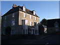
Fairwater House, High Street, Wroughton
Early 19th century Grade II Listed building. http://www.britishlistedbuildings.co.uk/en-318622-fairwater-house-wroughton-
Image: © Vieve Forward
Taken: 1 Jan 2013
0.11 miles
6
![Wroughton houses [20]](https://s0.geograph.org.uk/geophotos/06/42/23/6422384_5147b85e_120x120.jpg)
Wroughton houses [20]
Number 17 High Street is 18th century with later extensions and alterations under a thatched roof. Listed, grade II, with details at: https://historicengland.org.uk/listing/the-list/list-entry/1023442
The large village of Wroughton lies 2 miles south of Swindon at the foot of the Marlborough Downs escarpment. Two headstreams of the River Ray flow from the downs and meet in the village to run north as Wroughton Stream. There is much evidence of settlement and intensive farming of the area in the Roman period. Originally an agricultural village, most workers now commute into Swindon.
Image: © Michael Dibb
Taken: 11 Mar 2020
0.11 miles
7
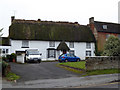
Thatched cottage, High Street, Wroughton
Moss-covered old thatch on the roof of a cottage, with a thatcher's truck outside.
Image: © Vieve Forward
Taken: 9 Feb 2017
0.11 miles
8
![Wroughton houses [18]](https://s1.geograph.org.uk/geophotos/06/42/17/6421717_c7523346_120x120.jpg)
Wroughton houses [18]
The east front of Fairwater House.
Fairwater House, built circa 1700, was the centre of a racehorse training and stabling establishment. The name Fairwater was adopted after a horse with that name won the Ascot Gold Vase. There is another view at Image Listed, grade II, with details at: https://historicengland.org.uk/listing/the-list/list-entry/1355920
The large village of Wroughton lies 2 miles south of Swindon at the foot of the Marlborough Downs escarpment. Two headstreams of the River Ray flow from the downs and meet in the village to run north as Wroughton Stream. There is much evidence of settlement and intensive farming of the area in the Roman period. Originally an agricultural village, most workers now commute into Swindon.
Image: © Michael Dibb
Taken: 11 Mar 2020
0.11 miles
9
![Wroughton features [12]](https://s0.geograph.org.uk/geophotos/06/42/17/6421712_017eff86_120x120.jpg)
Wroughton features [12]
A fine dragonfly sculpture in the pond.
The large village of Wroughton lies 2 miles south of Swindon at the foot of the Marlborough Downs escarpment. Two headstreams of the River Ray flow from the downs and meet in the village to run north as Wroughton Stream. There is much evidence of settlement and intensive farming of the area in the Roman period. Originally an agricultural village, most workers now commute into Swindon.
Image: © Michael Dibb
Taken: 11 Mar 2020
0.11 miles
10
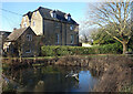
Wroughton Village Pond
Featuring a metal dragonfly sculpture.
Image: © Des Blenkinsopp
Taken: 19 Jan 2023
0.11 miles