
IMAGES TAKEN NEAR TO
Baileys Way, SWINDON, SN4 9AH
Introduction
This page details the photographs taken nearby to Baileys Way, SN4 9AH by members of the Geograph project.
The Geograph project started in 2005 with the aim of publishing, organising and preserving representative images for every square kilometre of Great Britain, Ireland and the Isle of Man.

There are currently over 7.5m images from over14,400 individuals and you can help contribute to the project by visiting https://www.geograph.org.uk
Image Map
Images are licensed for reuse under creativecommons.org/licenses/by-sa/2.0
Notes
- Clicking on the map will re-center to the selected point.
- The higher the marker number, the further away the image location is from the centre of the postcode.
Image Listing (12 Images Found)
Images are licensed for reuse under creativecommons.org/licenses/by-sa/2.0
Image
Details
Distance
5
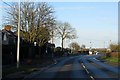
Moormead Road in Wroughton
Looking towards Swindon Road.
Image: © Steve Daniels
Taken: 9 Feb 2014
0.17 miles
7
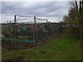
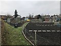
Wroughton allotments
Ready for spring planting.
Image: © Eirian Evans
Taken: 16 Feb 2011
0.21 miles
8
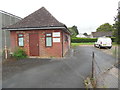
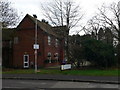
Former Telephone Exchange, Wroughton
Located at 27a Moormead Road SN4 9BU, this redbrick building used to serve as the telephone exchange for Wroughton until the 1970s. It has now been converted into offices. The present TE is the grey building to the left of the offices, https://www.geograph.org.uk/photo/6577844 refers.
Image: © David Hillas
Taken: 16 Aug 2019
0.22 miles
10
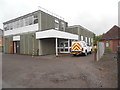
Wroughton Telephone Exchange
Situated in Moormead Road, this building dates from the 1970s having replaced the former TE to the right of the photo, https://www.geograph.org.uk/photo/6577834 refers. It has the code SSWGN and provides telephone and broadband services to 3,283 residential and 137 non-residential premises in Wroughton plus Overtown nearby. A BT vehicle can be seen parked by the side of the TE. The numbering ranges of this TE are (01793) 81xxxx, 845xxx, the (01793) referring to the Swindon group of fourteen TEs, and its postcode is SN4 9BU.
Image: © David Hillas
Taken: 16 Aug 2019
0.24 miles