1
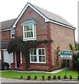
The Woodshaw pub and car park, Royal Wootton Bassett
The Arkell's Ales pub is located in Garraways, Woodshaw, Royal Wootton Bassett, viewed from Roebuck Close.
Image: © Jaggery
Taken: 2 Feb 2013
0.06 miles
2
The Woodshaw, Royal Wootton Bassett
The Arkell's Ales pub is located in Garraways, Woodshaw, Royal Wootton Bassett, viewed from Roebuck Close.
Image: © Jaggery
Taken: 2 Feb 2013
0.06 miles
3
The Woodshaw pub sign, Royal Wootton Bassett
The sign is on the corner of Roebuck Close, on the south side of this http://www.geograph.org.uk/photo/3318052 pub.
Image: © Jaggery
Taken: 2 Feb 2013
0.06 miles
4
Woodshaw roundabout, Wootton Bassett
The roundabout marks the extent of the developed part of Wootton Bassett on the eastern side of the town. the first exit to the left leads to an industrial area.
Image: © Brian Robert Marshall
Taken: 9 Apr 2008
0.10 miles
5
Tesco Express, Woodshaw, Royal Wootton Bassett
Part of a small group of shops on the north side of Roebuck Close, Woodshaw.
Image: © Jaggery
Taken: 2 Feb 2013
0.11 miles
6
Lee's Fish & Chips, Woodshaw, Royal Wootton Bassett
Part of a small group of shops on the north side of Roebuck Close.
Image: © Jaggery
Taken: 2 Feb 2013
0.11 miles
7
All routes, Royal Wootton Bassett
The informative sign is alongside Binknoll Lane in the SE of Royal Wootton Bassett.
Image: © Jaggery
Taken: 2 Feb 2013
0.15 miles
8
Road out of Wootton Bassett towards Harris Croft
Viewed facing east south east, the road leads eventually to Bincknoll Farm in SU1079 and no further.
Image: © Brian Robert Marshall
Taken: 9 Apr 2008
0.17 miles
9
Ravens Walk, Wootton Bassett
Near Swindon
Image: © Rick Crowley
Taken: 16 Aug 2002
0.19 miles


