
IMAGES TAKEN NEAR TO
Hedgerow Lane, SWINDON, SN4 8FW
Introduction
This page details the photographs taken nearby to Hedgerow Lane, SN4 8FW by members of the Geograph project.
The Geograph project started in 2005 with the aim of publishing, organising and preserving representative images for every square kilometre of Great Britain, Ireland and the Isle of Man.

There are currently over 7.5m images from over14,400 individuals and you can help contribute to the project by visiting https://www.geograph.org.uk
Image Map
Images are licensed for reuse under creativecommons.org/licenses/by-sa/2.0
Notes
- Clicking on the map will re-center to the selected point.
- The higher the marker number, the further away the image location is from the centre of the postcode.
Image Listing (23 Images Found)
Images are licensed for reuse under creativecommons.org/licenses/by-sa/2.0
Image
Details
Distance
1
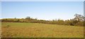
Field on slopes of Brynard's Hill
The hill, on the southeast edge of Wootton Bassett, is crossed by several footpaths and has been the subject of a planning battle over proposals for new homes. This view is from a passing train.
Image: © Derek Harper
Taken: 23 Nov 2012
0.03 miles
3
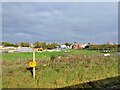
From a Swindon-Bristol train, new construction at Brynard Hill
The yellow (slightly blurred) 82¼ milepost is miles from London Paddington.
Image: © Nigel Thompson
Taken: 14 Oct 2017
0.09 miles
4
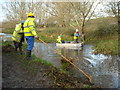
Weed cutting on the Wilts & Berks Canal
Volunteers from the Wilts & Berks Canal Trust http://www.wbct.org.uk/ removing weed from the canal. The man in the front of the boat operates the weed-cutter, a kind of underwater hedge-trimmer. When the weed has been cut free of its roots, the men on the towpath throw out large wooden rakes with 6" nails for tines which float on the water and drag the weed towards the bank. The piles of weed on the bank are then pitchforked out of sight in the hedge. When the canal was in use, the frequent passage of boats would have kept the canal free of weed, but as boats are not in use on this short stretch of canal, weed-cutting has to take place annually.
Image: © Vieve Forward
Taken: 18 Nov 2015
0.14 miles
5
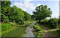
Wilts & Berks canal, near Royal Wootton Bassett
This section of the canal from SU0728581563 to SU0846781831 has recently been restored by the Wilts & Berks Canal Trust https://www.wbct.org.uk/ and is now navigable with a suitable craft Image
Image: © Brian Robert Marshall
Taken: 15 Sep 2018
0.15 miles
6
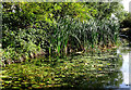
Reedmace and other aquatic plants, Wilts & Berks canal, Royal Wootton Bassett
Reedmace, sometimes called bulrush, are commonly seen along waterways and in ponds.
Image: © Brian Robert Marshall
Taken: 15 Sep 2018
0.15 miles
7
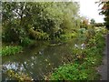
Restored section of Wilts & Berks Canal, Royal Wootton Bassett, Wilts
This is near the eastern end of the restored section of canal south of the town of Royal Wootton Bassett. In the distance is a footbridge taking a public footpath across the canal. A public footpath also runs along the towpath on the right.
Image
Image: © P L Chadwick
Taken: 24 Sep 2017
0.16 miles
8
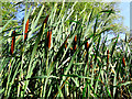
Reedmace, Wilts & Berks canal, Royal Wootton Bassett
Reedmace, otherwise known as bulrush, is an ubiquitous aquatic plant. It is seen here from a boat on the canal.
Image: © Brian Robert Marshall
Taken: 15 Sep 2018
0.17 miles
9
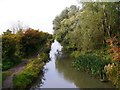
Restored section of Wilts & Berks Canal, Royal Wootton Bassett, Wilts
The section of towpath on the left is a public footpath.
Image: © P L Chadwick
Taken: 24 Sep 2017
0.17 miles
10
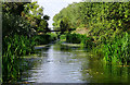
West along the Wilts & Berks canal, Royal Wootton Bassett
The canal here is lined on both sides by clumps of reedmace. In the distance is another footbridge over the canal. Seen from a small boat on a trip along the navigable stretch of the old canal.
Image: © Brian Robert Marshall
Taken: 15 Sep 2018
0.17 miles