IMAGES TAKEN NEAR TO
Broadacres, SWINDON, SN4 7RP
Introduction
This page details the photographs taken nearby to Broadacres, SN4 7RP by members of the Geograph project.
The Geograph project started in 2005 with the aim of publishing, organising and preserving representative images for every square kilometre of Great Britain, Ireland and the Isle of Man.

There are currently over 7.5m images from over14,400 individuals and you can help contribute to the project by visiting https://www.geograph.org.uk
Image Map
Images are licensed for reuse under creativecommons.org/licenses/by-sa/2.0
Notes
- Clicking on the map will re-center to the selected point.
- The higher the marker number, the further away the image location is from the centre of the postcode.
Image Listing (15 Images Found)
Images are licensed for reuse under creativecommons.org/licenses/by-sa/2.0
Image
Details
Distance
2
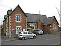
Broad Town Church of England Primary School
Image: © Nick Smith
Taken: 11 Jan 2012
0.18 miles
3

Detail, gravestone, Christ Church, Broad Town
This is a close-up of the grave marker in this image http://www.geograph.org.uk/photo/1015744 I guess it represents a flower of some sort; a tulip perhaps?
Image: © Brian Robert Marshall
Taken: 21 Oct 2008
0.22 miles
5

Gravestone, Christ Church, Broad Town
The fact that the grave marker is in the form of a cross means that this is Victorian or later as cruciform gravestones only came into fashion in the 19th century. The church is at the right, Behind is the scarp west of Uffcott.
Image: © Brian Robert Marshall
Taken: 21 Oct 2008
0.22 miles
6

Churchyard and graves, Christ Church, Broad Town
The eastern part of the churchyard crosses the eastern gridline of the square. Most of the graves visible here are in the square, the fence is just outside it. The white horse is about a kilometre away.
Image: © Brian Robert Marshall
Taken: 21 Oct 2008
0.22 miles
7
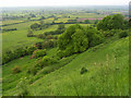
The view from Broad Town White Horse
The very steep scarp provides a wide-ranging vista over the relatively flat north Wiltshire countryside and its patchwork of mostly pastoral fields.
Image: © Andrew Smith
Taken: 31 May 2008
0.23 miles
8

Churchyard, Christ Church, Broad Town
The church is without a spire or tower, hence it's easy to miss on the map. It is just inside the eastern edge of the square. I think the church dates to the mid 18th century.
Image: © Brian Robert Marshall
Taken: 21 Oct 2008
0.23 miles
9
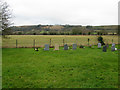
View from Broad Town churchyard
The chalk horse hill figure can just be seen in the background.
Image: © Nick Smith
Taken: 11 Jan 2012
0.23 miles