
IMAGES TAKEN NEAR TO
Saffron Close, SWINDON, SN4 7JD
Introduction
This page details the photographs taken nearby to Saffron Close, SN4 7JD by members of the Geograph project.
The Geograph project started in 2005 with the aim of publishing, organising and preserving representative images for every square kilometre of Great Britain, Ireland and the Isle of Man.

There are currently over 7.5m images from over14,400 individuals and you can help contribute to the project by visiting https://www.geograph.org.uk
Image Map
Images are licensed for reuse under creativecommons.org/licenses/by-sa/2.0
Notes
- Clicking on the map will re-center to the selected point.
- The higher the marker number, the further away the image location is from the centre of the postcode.
Image Listing (55 Images Found)
Images are licensed for reuse under creativecommons.org/licenses/by-sa/2.0
Image
Details
Distance
1
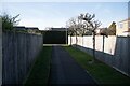
Royal Wootton Bassett : Whitehorn Close
A footpath off Whitehorn Close.
Image: © Lewis Clarke
Taken: 4 Mar 2025
0.04 miles
2
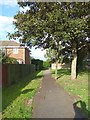
One of several paths on the housing estate near Jubilee Park
Having left Jubilee Park by a different path from the one near the car park where I'd entered, I then found myself lost on a housing estate. I blame modern planners who will insist on building estates on curved roads - most disorientating.
Image: © Penny Mayes
Taken: 5 Oct 2013
0.05 miles
3
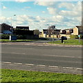
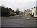
Maple Drive junction, Royal Wootton Bassett
Viewed across the A3102 from near the Royal Wootton Bassett boundary sign. http://www.geograph.org.uk/photo/3408092
Image: © Jaggery
Taken: 2 Feb 2013
0.07 miles
4

Royal Wootton Bassett : Elm Close
Looking along Elm Close off Whitehorn Close.
Image: © Lewis Clarke
Taken: 4 Mar 2025
0.07 miles
5
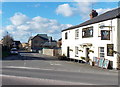
Old Malmesbury Road near Royal Wootton Bassett
Viewed across the A3102 past the Prince of Wales pub. http://www.geograph.org.uk/photo/3408188
Now a quiet cul-de-sac, the 200 metre long road ahead was formerly part of the B4042 in the northern outskirts of Royal Wootton Bassett. The B4042 now follows a course 50 metres to the NE, to the right of the pub. http://www.geograph.org.uk/photo/3408319
Image: © Jaggery
Taken: 2 Feb 2013
0.07 miles
7
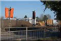
Royal Wootton Bassett : Malmesbury Road B4042
A road and crossing with construction site opposite.
Image: © Lewis Clarke
Taken: 4 Mar 2025
0.08 miles
8

Royal Wootton Bassett : Saffron Close
Houses on Saffron Close.
Image: © Lewis Clarke
Taken: 4 Mar 2025
0.08 miles
9
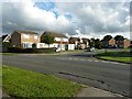
Laburnam Drive viewed across Maple Drive
Having left Jubilee Park by a different path from the one near the car park where I'd entered, I then found myself lost on a housing estate.
Image: © Penny Mayes
Taken: 5 Oct 2013
0.08 miles
10

Royal Wootton Bassett Road Sign
New road signs were erected in 2011 when the prefix "Royal" was conferred on Wootton Bassett in recognition of its years commemorating the fallen as their coffins were repatriated via the town's High Street. This sign is to the west of the Coped Hall roundabout, north of the town.
Image: © Vieve Forward
Taken: 19 Jan 2012
0.10 miles