
IMAGES TAKEN NEAR TO
The Barton, SWINDON, SN4 7BG
Introduction
This page details the photographs taken nearby to The Barton, SN4 7BG by members of the Geograph project.
The Geograph project started in 2005 with the aim of publishing, organising and preserving representative images for every square kilometre of Great Britain, Ireland and the Isle of Man.

There are currently over 7.5m images from over14,400 individuals and you can help contribute to the project by visiting https://www.geograph.org.uk
Image Map
Images are licensed for reuse under creativecommons.org/licenses/by-sa/2.0
Notes
- Clicking on the map will re-center to the selected point.
- The higher the marker number, the further away the image location is from the centre of the postcode.
Image Listing (199 Images Found)
Images are licensed for reuse under creativecommons.org/licenses/by-sa/2.0
Image
Details
Distance
1
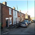
Houses at the NW end of Wood Street, Royal Wootton Bassett
These houses beyond the United Reformed Church http://www.geograph.org.uk/photo/3378693 are set above road level.
Image: © Jaggery
Taken: 2 Feb 2013
0.01 miles
2
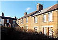
The Barton, Royal Wootton Bassett
The Barton is an L-shaped cul-de-sac at the NW end of Wood Street.
Image: © Jaggery
Taken: 2 Feb 2013
0.01 miles
3
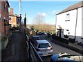
NW end of Wood Street, Royal Wootton Bassett
There is open countryside, partly wooded, beyond the NW end of Wood Street.
The left turn is into The Barton. Viewed from an elevated pavement. http://www.geograph.org.uk/photo/3383741
Image: © Jaggery
Taken: 2 Feb 2013
0.01 miles
4
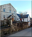
United Reformed Church, Royal Wootton Bassett
Located in Wood Street.
The church was built in 1825 as The Congregational Church of Wootton Bassett.
Image: © Jaggery
Taken: 2 Feb 2013
0.04 miles
5
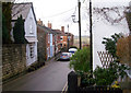
Wood Street, Wootton Bassett
The western end of Wood Street. The road end by the last house visible, which is on the edge of the limestone ridge on which the town stands. From here, a footpath drops down the steep slope into the fields of Dauntsey Vale.
Image: © Chris Randall
Taken: 16 Jan 2009
0.05 miles
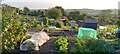
7
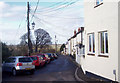
Church Street, Wootton Bassett
The western end of Church Street. There are no houses on the left, because the ground drops sharply to land used as allotments. The trees in the background are growing on a mound that could well be the site of a windmill shown on Andrews' and Drury's map of 1810.
Image: © Chris Randall
Taken: 16 Jan 2009
0.07 miles
8
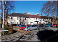
Victory Row, Royal Wootton Bassett
Viewed from the edge of a Wood Street car park.
Victory Row is a row of 15 houses built by William Cripps to celebrate a Whig victory in 1817.
Image: © Jaggery
Taken: 2 Feb 2013
0.07 miles
9
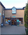
Wootton Bassett Library, Royal Wootton Bassett
The Wiltshire Council public library is on the NW side of Borough Fields shopping centre.
Image: © Jaggery
Taken: 2 Feb 2013
0.10 miles
10
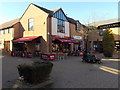
Costa, Royal Wootton Bassett
Costa's coffee shop at 16 Borough Fields shopping centre opened on December 5th 2011.
On the right are a Blue Cross charity shop and public toilets.
Image: © Jaggery
Taken: 2 Feb 2013
0.11 miles