
IMAGES TAKEN NEAR TO
Wanborough, SWINDON, SN4 0SW
Introduction
This page details the photographs taken nearby to SN4 0SW by members of the Geograph project.
The Geograph project started in 2005 with the aim of publishing, organising and preserving representative images for every square kilometre of Great Britain, Ireland and the Isle of Man.

There are currently over 7.5m images from over14,400 individuals and you can help contribute to the project by visiting https://www.geograph.org.uk
Image Map
Images are licensed for reuse under creativecommons.org/licenses/by-sa/2.0
Notes
- Clicking on the map will re-center to the selected point.
- The higher the marker number, the further away the image location is from the centre of the postcode.
Image Listing (84 Images Found)
Images are licensed for reuse under creativecommons.org/licenses/by-sa/2.0
Image
Details
Distance

2
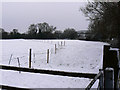
Towards the Great Western Hospital, Swindon
The hospital, or the part visible here, is in this square. The viewpoint is from near Pack Hill.
Image: © Brian Robert Marshall
Taken: 2 Feb 2009
0.03 miles
3
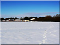
Towards Moor Leaze, Swindon
The A419 is just out of shot to the left. Moor Leaze is a diversified farm whose enterprises include a dancing school.
Image: © Brian Robert Marshall
Taken: 7 Feb 2009
0.08 miles
4
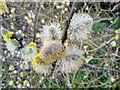
Hazel catkins, Wanborough, Wiltshire
Another sign that spring is here. Taken in compliance with SI 2020 no. 350.
Image: © Brian Robert Marshall
Taken: 31 Mar 2020
0.09 miles
5
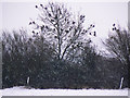
Wood pigeons, near Wanborough
These very common birds are perched in a tree during a snow shower.
Image: © Brian Robert Marshall
Taken: 2 Feb 2009
0.10 miles
6
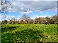
View from the earthworks, Moor Leaze, Wanborough
Although the horse chestnut trees are breaking their buds Image it will be a while yet before they are in full leaf Image Taken in compliance with SI 2020 no. 350.
Image: © Brian Robert Marshall
Taken: 31 Mar 2020
0.11 miles
7
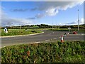
Southern Connector Road, Wanborough, Swindon (2)
One of a few photos of a new road built but not yet in use. This view shows the revised layout to allow access to Upper Wanborough via Pack Hill.
Image: © Brian Robert Marshall
Taken: 5 Nov 2023
0.11 miles
8

Earthworks, Moor Leaze, Wanborough, Swindon
The earthworks only appear on Ordnance Survey maps from about 1923 onwards. Maybe no-one had spotted them before then or perhaps they really are relatively modern.
Image: © Brian Robert Marshall
Taken: 25 Jul 2018
0.12 miles
9
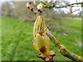
Horse chestnut bud, Wanborough, Swindon
Known to most as a sticky bud. Taken in compliance with SI 2020 no. 350.
Image: © Brian Robert Marshall
Taken: 31 Mar 2020
0.12 miles
10
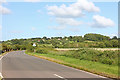
Moor Leaze
Looking towards Pack Hill and Wanborough.
Image: © Wayland Smith
Taken: 21 Jun 2020
0.13 miles