IMAGES TAKEN NEAR TO
Church Road, SWINDON, SN4 0HB
Introduction
This page details the photographs taken nearby to Church Road, SN4 0HB by members of the Geograph project.
The Geograph project started in 2005 with the aim of publishing, organising and preserving representative images for every square kilometre of Great Britain, Ireland and the Isle of Man.

There are currently over 7.5m images from over14,400 individuals and you can help contribute to the project by visiting https://www.geograph.org.uk
Image Map
Images are licensed for reuse under creativecommons.org/licenses/by-sa/2.0
Notes
- Clicking on the map will re-center to the selected point.
- The higher the marker number, the further away the image location is from the centre of the postcode.
Image Listing (46 Images Found)
Images are licensed for reuse under creativecommons.org/licenses/by-sa/2.0
Image
Details
Distance
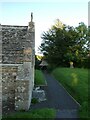
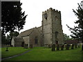
1
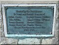
All Saints, Liddington: war memorial in the lych gate
Image: © Basher Eyre
Taken: 4 Sep 2023
0.01 miles
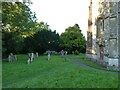
3
All Saints'
Graveyard at All Saints', Liddington.
Image: © Wayland Smith
Taken: 21 Jun 2020
0.02 miles
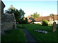
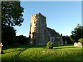
4
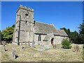
All Saints church, Liddington
Liddington parish church is oddly situated to the south of the village, on the other side of the main road (the B4192) from nearly all the rest of the village.
Image: © David Purchase
Taken: 16 Jun 2012
0.03 miles
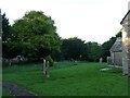
5
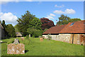
SU20628125 All Saints, Liddington: early September 2023
Image: © Basher Eyre
Taken: 4 Sep 2023
0.03 miles