
IMAGES TAKEN NEAR TO
Kite Hill, SWINDON, SN4 0AW
Introduction
This page details the photographs taken nearby to Kite Hill, SN4 0AW by members of the Geograph project.
The Geograph project started in 2005 with the aim of publishing, organising and preserving representative images for every square kilometre of Great Britain, Ireland and the Isle of Man.

There are currently over 7.5m images from over14,400 individuals and you can help contribute to the project by visiting https://www.geograph.org.uk
Image Map
Images are licensed for reuse under creativecommons.org/licenses/by-sa/2.0
Notes
- Clicking on the map will re-center to the selected point.
- The higher the marker number, the further away the image location is from the centre of the postcode.
Image Listing (5 Images Found)
Images are licensed for reuse under creativecommons.org/licenses/by-sa/2.0
Image
Details
Distance
1
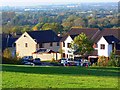
Houses in Rodway Hill, Wanborough
A cross-gridline shot. The houses are in Lower Wanborough while the viewpoint is in Stacey's Lane, Upper Wanborough. The development on the horizon is the eastern edge of Swindon.
Image: © Brian Robert Marshall
Taken: 12 Oct 2008
0.16 miles
2
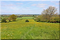
View from Upper Wanborough
View across fields from Upper Wanborough towards the edge of Swindon.
Image: © Wayland Smith
Taken: 3 May 2014
0.21 miles
3
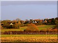
Upper Wanborough, Swindon
The village of Wanborough is situated on the top of a hill and spreads down the north face of the hill. The maps refer to 'Wanborough' as the part at the top and to 'Lower Wanborough' being the rest. Locally the term 'Upper Wanborough' is used to distinguish the higher part.
Image: © Brian Robert Marshall
Taken: 1 Dec 2007
0.23 miles
5
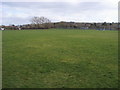
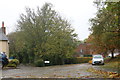
Hooper's Field
Hooper's Field Wanborough
Image: © Shaun Ferguson
Taken: 8 Mar 2012
0.25 miles