
IMAGES TAKEN NEAR TO
Eagle Close, SWINDON, SN3 5DT
Introduction
This page details the photographs taken nearby to Eagle Close, SN3 5DT by members of the Geograph project.
The Geograph project started in 2005 with the aim of publishing, organising and preserving representative images for every square kilometre of Great Britain, Ireland and the Isle of Man.

There are currently over 7.5m images from over14,400 individuals and you can help contribute to the project by visiting https://www.geograph.org.uk
Image Map
Images are licensed for reuse under creativecommons.org/licenses/by-sa/2.0
Notes
- Clicking on the map will re-center to the selected point.
- The higher the marker number, the further away the image location is from the centre of the postcode.
Image Listing (27 Images Found)
Images are licensed for reuse under creativecommons.org/licenses/by-sa/2.0
Image
Details
Distance
1
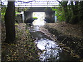
Dorcan Stream in Covingham, Swindon
The bridge carries the A419 road over the stream.
Image: © Nigel Cox
Taken: 12 Oct 2007
0.03 miles
2
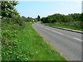
Wanborough Road, Covingham, Swindon
Long renamed Wanborough Road, originally it was a Roman road called, according to the current 1:25K map, Ermin Way. I always thought it was Ermin Street. This is a view to the south-east.
Image: © Brian Robert Marshall
Taken: 13 May 2008
0.11 miles
3
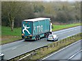
TDG HGV going south, A419, Swindon
TDG started life in 1922 under a different name. TDG is a contraction of Transport Development Group, the name the company adopted in 1957. Since 2011 TDG has been owned by the Norbert Dentressangle company and reportedly no longer trades as a separate enterprise. The truck is being overtaken by an Audi tourer (the current designation for what used to be estate cars). Both are heading towards the M4 motorway.
Image: © Brian Robert Marshall
Taken: 9 Feb 2014
0.11 miles
4
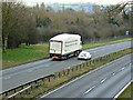
M&S HGV going south, A419, Swindon
A Ford Mondeo is overtaking a truck probably on its way to service some of the many branches of the well-known retailer of fashion and food. The A419 links the M5 and M4 motorways, the latter of which is a few kilometres further on.
Image: © Brian Robert Marshall
Taken: 9 Feb 2014
0.11 miles
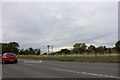
6
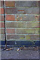
Benchmark on St Paul's Drive wall
Ordnance Survey cut mark benchmark described on the Bench Mark Database at http://www.bench-marks.org.uk/bm56145
Image: © Roger Templeman
Taken: 9 Apr 2015
0.12 miles
7
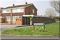
Junction of Gantlettdene and St Paul's Drive
There is an OS benchmark Image on the garage wall, above the pavement of St Paul's Drive (at the junction of the garage and car port walls)
Image: © Roger Templeman
Taken: 9 Apr 2015
0.12 miles
8
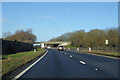
Northbound A419
Bypassing Swindon to the east.
Image: © Robin Webster
Taken: 9 Jan 2022
0.12 miles
10
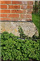
Benchmark on #3 Lotmead Cottages
Ordnance Survey cut mark benchmark described on the Bench Mark Database at http://www.bench-marks.org.uk/bm56157
Image: © Roger Templeman
Taken: 9 Apr 2015
0.14 miles