IMAGES TAKEN NEAR TO
Gifford Road, SWINDON, SN3 4XP
Introduction
This page details the photographs taken nearby to Gifford Road, SN3 4XP by members of the Geograph project.
The Geograph project started in 2005 with the aim of publishing, organising and preserving representative images for every square kilometre of Great Britain, Ireland and the Isle of Man.

There are currently over 7.5m images from over14,400 individuals and you can help contribute to the project by visiting https://www.geograph.org.uk
Image Map
Images are licensed for reuse under creativecommons.org/licenses/by-sa/2.0
Notes
- Clicking on the map will re-center to the selected point.
- The higher the marker number, the further away the image location is from the centre of the postcode.
Image Listing (79 Images Found)
Images are licensed for reuse under creativecommons.org/licenses/by-sa/2.0
Image
Details
Distance
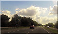
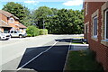
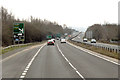
3
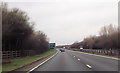
A419 round junction at Stratton St Margaret
Image: © John Firth
Taken: 17 Apr 2013
0.10 miles
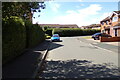
5
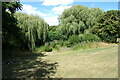
Dew Pond off Rainer Close & Church Street
Near St. Margaret's Church
Image: © Geographer
Taken: 14 Jul 2022
0.12 miles
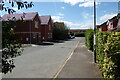
6
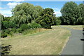
Green off Rainer Close & Church Street
Near St. Margaret's Church & the Pond
Image: © Geographer
Taken: 14 Jul 2022
0.13 miles
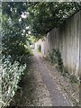
7
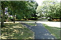
Path to Rainer Close
Near St. Margaret's Church
Image: © Geographer
Taken: 14 Jul 2022
0.14 miles