
IMAGES TAKEN NEAR TO
Wingfield, SWINDON, SN3 4UR
Introduction
This page details the photographs taken nearby to Wingfield, SN3 4UR by members of the Geograph project.
The Geograph project started in 2005 with the aim of publishing, organising and preserving representative images for every square kilometre of Great Britain, Ireland and the Isle of Man.

There are currently over 7.5m images from over14,400 individuals and you can help contribute to the project by visiting https://www.geograph.org.uk
Image Map
Images are licensed for reuse under creativecommons.org/licenses/by-sa/2.0
Notes
- Clicking on the map will re-center to the selected point.
- The higher the marker number, the further away the image location is from the centre of the postcode.
Image Listing (13 Images Found)
Images are licensed for reuse under creativecommons.org/licenses/by-sa/2.0
Image
Details
Distance
1
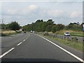
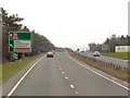
A419 at Kingsdown
The broken white lines on the left indicate the end of the northbound entry slip road from the A361. For more details of that junction, see: http://www.geograph.org.uk/photo/2088201 and http://www.geograph.org.uk/photo/2088209.
Image: © J Whatley
Taken: 22 Sep 2010
0.15 miles
4
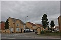
Kingsdown Gate, Upper Stratton
At the junction of Ermin Street
Image: © David Howard
Taken: 9 Sep 2018
0.17 miles
5
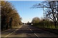
Ermin Street in Stratton St Margaret
Ermin Street follows a former Roman Road.
Image: © Steve Daniels
Taken: 9 Mar 2014
0.18 miles
7
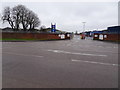
Stratton railway station (site), Swindon
Opened in 1883 by the Great Western Railway on the branch line from Swindon to Highworth, this station closed to passengers in 1953 and completely in 1962.
View south west towards Swindon from what had been the Ermin Street bridge over the railway, the line and single platform having been just to the left of the blue sign. No trace of the station remains, the station site and bridge having been levelled.
Image: © Nigel Thompson
Taken: 31 Mar 2018
0.23 miles
8
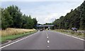
A419 heading north west round Swindon
Image: © Julian P Guffogg
Taken: 7 Aug 2013
0.24 miles
9
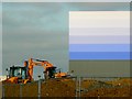
South-western corner of the B&Q Distribution Centre, Stratton, Swindon
The façade of the building has been coated in progressively lighter colours from mid-blue to white as the eye travels upward. This is so that the visual impact of the huge building is minimised. It is unlikely the planners would have allowed the building to be painted in B&Q's trademark orange Image For an account of the development history of this building see Image
Image: © Brian Robert Marshall
Taken: 24 Feb 2011
0.24 miles
10
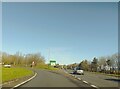
A361 junction on A419 northbound
A junction leading to the A361, off the A419 northbound. A sign gives the destinations of Highworth, Burford, Honda, Stratton, S. Marston and a crematorium.
Image: © Oscar Taylor
Taken: 7 Apr 2023
0.24 miles