
IMAGES TAKEN NEAR TO
Fuller Gardens, SWINDON, SN3 4RP
Introduction
This page details the photographs taken nearby to Fuller Gardens, SN3 4RP by members of the Geograph project.
The Geograph project started in 2005 with the aim of publishing, organising and preserving representative images for every square kilometre of Great Britain, Ireland and the Isle of Man.

There are currently over 7.5m images from over14,400 individuals and you can help contribute to the project by visiting https://www.geograph.org.uk
Image Map
Images are licensed for reuse under creativecommons.org/licenses/by-sa/2.0
Notes
- Clicking on the map will re-center to the selected point.
- The higher the marker number, the further away the image location is from the centre of the postcode.
Image Listing (4 Images Found)
Images are licensed for reuse under creativecommons.org/licenses/by-sa/2.0
Image
Details
Distance
1
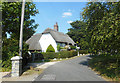
Thatched House, South Marston
The factories and warehouses of outer Swindon are peering over the back fence, but there are still some nice bits of old village left in South Marston.
Image: © Des Blenkinsopp
Taken: 11 Aug 2020
0.14 miles
2
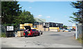
Crocodile Packaging
Another business premises in an area of edge of town industrial estates.
The guy with the car is loading wood offcuts into the back. He probably has a stove.
Image: © Des Blenkinsopp
Taken: 11 Aug 2020
0.17 miles
3
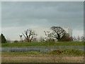
Isotron, Thornhill Road, South Marston, Swindon
This building is used to irradiate materials such as wire, cable and tubing with electron beams. The view is from the Keypoint distribution centre which straddles this and the next square south.
Image: © Brian Robert Marshall
Taken: 7 Jan 2007
0.18 miles
4
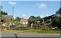
Dereliction at Oxleaze Farm
Farming days are over for this place. Just waiting for the builders to move in.
Image: © Des Blenkinsopp
Taken: 11 Aug 2020
0.25 miles