
IMAGES TAKEN NEAR TO
Weedon Road, SWINDON, SN3 4EN
Introduction
This page details the photographs taken nearby to Weedon Road, SN3 4EN by members of the Geograph project.
The Geograph project started in 2005 with the aim of publishing, organising and preserving representative images for every square kilometre of Great Britain, Ireland and the Isle of Man.

There are currently over 7.5m images from over14,400 individuals and you can help contribute to the project by visiting https://www.geograph.org.uk
Image Map
Images are licensed for reuse under creativecommons.org/licenses/by-sa/2.0
Notes
- Clicking on the map will re-center to the selected point.
- The higher the marker number, the further away the image location is from the centre of the postcode.
Image Listing (19 Images Found)
Images are licensed for reuse under creativecommons.org/licenses/by-sa/2.0
Image
Details
Distance
1
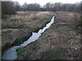
River Cole, near Greenbridge
The River Cole emerges from the bowels of Swindon not far from here and runs through this scruffy patch of wilderness out of sight of the nearby Greenbridge Trading Estate, the WHSmith headquarters, and the Covingham housing estate. It flows out of Swindon and via Coleshill to join the Thames just below Lechlade.
Image: © Vieve Forward
Taken: 22 Mar 2013
0.06 miles
2
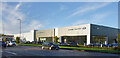
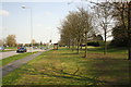
Land Rover & Jaguar Showrooms, Dorcan Way
Vehicle showrooms near the Greenbridge Roundabout.
Image: © Des Blenkinsopp
Taken: 9 Nov 2022
0.14 miles
7
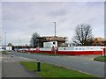
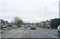
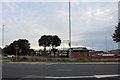
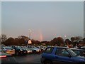
Former Brown Brothers site, Greenbridge, Swindon
First seen in this image Image and secondly here Image the site is now being redeveloped for residential use. The site, when complete, will be known as Dorcan Square reflecting the historical name of the area between Stratton St Margaret and Coate.
Image: © Brian Robert Marshall
Taken: 4 Dec 2007
0.20 miles
8
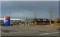
Greenbridge Retail Park, Drake's Way, Swindon
The retail park is in two parts, north and south. This is the northern section which is all retail. The southern part includes some retail outlets but is predominantly leisure oriented with a multiscreen cinema, a bingo hall and several restaurants. Visible in this image are McDonald's Drive-Thru, Next clothes retailer, JJB sportswear shop and Brantano shoe store. The area was previously an industrial area.
Image: © Brian Robert Marshall
Taken: 13 Nov 2007
0.21 miles
9
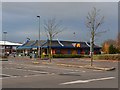
McDonald's Drive-Thru, Greenbridge Retail Park, Drake's Way, Swindon
McDonald's is a popular fast food outlet with a world-wide network of branches. This one is about 15 years old and does a brisk business. It is one of two drive-thrus in Swindon. There is also a town centre store. I have recently obtained an image of the Cirencester McDonald's which can be viewed here http://www.geograph.org.uk/photo/608964
Image: © Brian Robert Marshall
Taken: 13 Nov 2007
0.21 miles
10
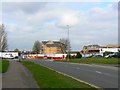
Dorcan Square, Greenbridge, Swindon
This is a follow-up to Image three months on. Marketing of the development has just started; hardly fortuitous timing given the reduction in mortgage availability resulting from the 'credit crunch' caused in large part by the sub-prime mess in America. The project hasn't yet been completed as can be seen at the right of the image.
Image: © Brian Robert Marshall
Taken: 3 Apr 2008
0.21 miles