
IMAGES TAKEN NEAR TO
Karslake Close, SWINDON, SN3 3SX
Introduction
This page details the photographs taken nearby to Karslake Close, SN3 3SX by members of the Geograph project.
The Geograph project started in 2005 with the aim of publishing, organising and preserving representative images for every square kilometre of Great Britain, Ireland and the Isle of Man.

There are currently over 7.5m images from over14,400 individuals and you can help contribute to the project by visiting https://www.geograph.org.uk
Image Map
Images are licensed for reuse under creativecommons.org/licenses/by-sa/2.0
Notes
- Clicking on the map will re-center to the selected point.
- The higher the marker number, the further away the image location is from the centre of the postcode.
Image Listing (33 Images Found)
Images are licensed for reuse under creativecommons.org/licenses/by-sa/2.0
Image
Details
Distance
1
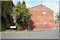
#1 Mundy Avenue
There is an OS benchmark Image on the right hand side of the house at the front corner
Image: © Roger Templeman
Taken: 17 Apr 2015
0.03 miles
2
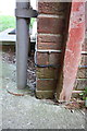
Benchmark on #1 Mundy Avenue
Ordnance Survey cut mark benchmark described on the Bench Mark Database at http://www.bench-marks.org.uk/bm65978
Image: © Roger Templeman
Taken: 17 Apr 2015
0.03 miles
3
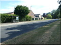
Bus stop on Eldene Drive, Swindon
Close to Reeves Close.
Image: © Christine Johnstone
Taken: 14 Jul 2022
0.05 miles
4
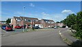
North side of Laurence Close, Eldene, Swindon
Looking north from a public footpath.
Image: © Christine Johnstone
Taken: 14 Jul 2022
0.06 miles
5
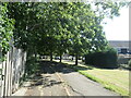
Public open space, Eldene, Swindon
Between Fanstones Road and Compton Close. Another Swindon suburb with a lot of open spaces and public footpaths.
Image: © Christine Johnstone
Taken: 14 Jul 2022
0.11 miles
6
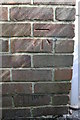
Benchmark on garage of #10 Haynes Close
Ordnance Survey cut mark benchmark described on the Bench Mark Database at http://www.bench-marks.org.uk/bm65980
Image: © Roger Templeman
Taken: 17 Apr 2015
0.12 miles
7
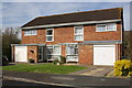
Houses on Haynes Close
There is an OS benchmark Image on the left hand side of the garage of the left hand house
Image: © Roger Templeman
Taken: 17 Apr 2015
0.13 miles
8
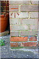
Benchmark on #245 Whitbourne Avenue
Ordnance Survey cut mark benchmark described on the Bench Mark Database at http://www.bench-marks.org.uk/bm66093
Image: © Roger Templeman
Taken: 13 Apr 2015
0.14 miles
9
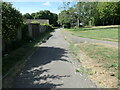
Cycleway and public footpath, Eldene, Swindon
Behind back gardens of houses on the east side of Fanstones Road.
Image: © Christine Johnstone
Taken: 14 Jul 2022
0.14 miles
10
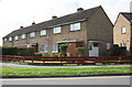
Row of houses on Whitbourne Avenue seen across Shaftesbury Avenue
There is an OS benchmark Image on the corner of the near house left of its white door.
Image: © Roger Templeman
Taken: 13 Apr 2015
0.14 miles