
IMAGES TAKEN NEAR TO
Norfolk Close, SWINDON, SN3 3DW
Introduction
This page details the photographs taken nearby to Norfolk Close, SN3 3DW by members of the Geograph project.
The Geograph project started in 2005 with the aim of publishing, organising and preserving representative images for every square kilometre of Great Britain, Ireland and the Isle of Man.

There are currently over 7.5m images from over14,400 individuals and you can help contribute to the project by visiting https://www.geograph.org.uk
Image Map
Images are licensed for reuse under creativecommons.org/licenses/by-sa/2.0
Notes
- Clicking on the map will re-center to the selected point.
- The higher the marker number, the further away the image location is from the centre of the postcode.
Image Listing (25 Images Found)
Images are licensed for reuse under creativecommons.org/licenses/by-sa/2.0
Image
Details
Distance
1

Frobisher Drive, Walcot, Swindon
Leading away from the viewpoint is Frobisher Drive. The roads in Walcot are named after famous figures from the Elizabethan age, in this case, Sir Martin Frobisher http://en.wikipedia.org/wiki/Martin_Frobisher
NOTE. This image has a detailed ‘shared description’ which you won’t see by viewing this image on a slideshow. To read it click on the image.
Image: © Brian Robert Marshall
Taken: 2 Jan 2010
0.10 miles
2
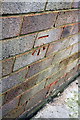
Benchmark on 29 Dacre Road
Ordnance Survey cut mark benchmark described on the Bench Mark Database at http://www.bench-marks.org.uk/bm55682
Image: © Roger Templeman
Taken: 13 Apr 2015
0.12 miles
3
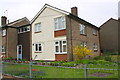
Housing on Dacre Road
There is an OS benchmark Image on the corner (right hand face) of the near house
Image: © Roger Templeman
Taken: 13 Apr 2015
0.12 miles
4
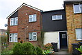
#32 Marlowe Avenue
There is an OS benchmark Image on the front of the house at the left hand corner
Image: © Roger Templeman
Taken: 13 Apr 2015
0.13 miles
5

Benchmark on #32 Marlowe Avenue
Ordnance Survey cut mark benchmark described on the Bench Mark Database at http://www.bench-marks.org.uk/bm55681
Image: © Roger Templeman
Taken: 13 Apr 2015
0.13 miles
6
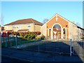
St Andrew's Church Centre, Raleigh Avenue, Walcot
The building seen here at the right was originally used as the church hall for St Andrew's church which once stood where the maisonettes can be seen at the left. Unfortunately the original church had to be demolished for structural reasons.
NOTE. This image has a detailed ‘shared description’ which you won’t see by viewing this image on a slideshow. To read it click on the image.
Image: © Brian Robert Marshall
Taken: 2 Jan 2010
0.15 miles
7
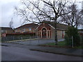
St. Andrew's Church Centre, Raleigh Avenue, Walcot
The building to the left is Harry Edwards Court, a Salvation Army Housing Association property.
Image: © Vieve Forward
Taken: 28 Dec 2012
0.15 miles
8
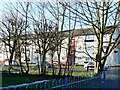
Flats, Somerville Road, Walcot, Swindon
Somerville Road is named after a famous Elizabethan as are most of the roads in Walcot. The estate comprises a mix of terraced houses and maisonettes.
NOTE. This image has a detailed ‘shared description’ which you won’t see by viewing this image on a slideshow. To read it click on the image.
Image: © Brian Robert Marshall
Taken: 2 Jan 2010
0.18 miles
9
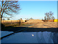
Site of University of Bath in Swindon, Marlowe Avenue, Swindon
In 1960 on this site a brand new grammar school opened called Park Grammar School. It became a comprehensive in the mid 1960s called variously Park Senior High, Park School and Oakfield. It closed in 2000 and was then re-opened as an outpost of the University of Bath. They closed their operations here in 2008 and the building remained empty until it was demolished recently so that business rates could be avoided. See Image for a wider view. Visible in the background is this building Image
Image: © Brian Robert Marshall
Taken: 2 Jan 2010
0.18 miles
10
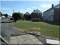
Courtenay Road, Walcot East, Swindon
South from the junction with Naunton Road.
Image: © Christine Johnstone
Taken: 14 Jul 2022
0.19 miles